
South & Middle Moat to Red Ridge Trail
HIKE: South & North Moat Mountain to Red Ridge Trail
South & Middle Moat to Red Ridge Trail
HIKE: South & North Moat Mountain to Red Ridge Trail
Details
We will hike the South Moat and Middle Moat to the Red Ridge trail junction. This is an out and back hike with total round trip distance of 8.4 miles and elevation gain of 2,650 feet.
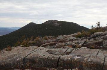
The Moat ridge is a long north-south running ridge, with many peaks along the crest. The three most significant peaks on the main ridge are North, Middle, and South Moat Mountain - all crossed by the Moat Mountain Trail. These three peaks have open rocky summits with spectacular 360-degree panoramas – among the best in the region. To the west, you look out over the Sandwich Range and the valley of the Kancamagus Highway. To the northwest, over the rest of the Moat Range, you look into the center of the White Mountains.
Estimated Elevation Gain: 2,650 feet
Estimated Round Trip Distance: 8.4 miles
Estimated Duration (with lunch): 6.5 hours
Hiking Essentials: See the following link for recommendations from GayOutdoors:
https://www.gayoutdoors.org/page.cfm?typeofsite=storydetail&id=992&storyset=yes
Directions
The trailhead is located on Passaconaway Rd (formerly Dugway Rd).
At the lights in Conway village NH16 turn north (directly opposite NH 153) onto Washington St., which becomes West Side Rd. Go left at a fork, then at 0.9 mi. turn left on Passaconaway Rd. (which becomes Dugway Rd.). The Moat Mtn.Trailhead (which is on the right) is approximately 2.3 miles from the turn onto Passaconaway Rd.
About this event
We will hike the South Moat and Middle Moat to the Red Ridge trail junction. This is an out and back hike with total round trip distance of 8.4 miles and elevation gain of 2,650 feet.
The Moat ridge is a long north-south running ridge, with many peaks along the crest. The three most significant peaks on the main ridge are North, Middle, and South Moat Mountain - all crossed by the Moat Mountain Trail. These three peaks have open rocky summits with spectacular 360-degree panoramas – among the best in the region. To the west, you look out over the Sandwich Range and the valley of the Kancamagus Highway. To the northwest, over the rest of the Moat Range, you look into the center of the White Mountains.
Estimated Elevation Gain: 2,650 feet
Estimated Round Trip Distance: 8.4 miles
Estimated Duration (with lunch): 6.5 hours
Hiking Essentials: See the following link for recommendations from GayOutdoors:
https://www.gayoutdoors.org/page.cfm?typeofsite=storydetail&id=992&storyset=yes
Directions to the trailhead
Get directionsThe trailhead is located on Passaconaway Rd (formerly Dugway Rd).
At the lights in Conway village NH16 turn north (directly opposite NH 153) onto Washington St., which becomes West Side Rd. Go left at a fork, then at 0.9 mi. turn left on Passaconaway Rd. (which becomes Dugway Rd.). The Moat Mtn.Trailhead (which is on the right) is approximately 2.3 miles from the turn onto Passaconaway Rd.
Who's going (6)



Questions about this event?
Reach out to the host, baezfred, for route details, carpooling, or what to bring.
Email the hostYou can also ask in the event discussion below.
Event discussion
We are going to stay with the original out & back hike. Trail conditions are currently much better hiking from the south side. Also we have car spotting / timing issues with doggies in daycare.
Log in to join the conversation.