
The Pemi Loop
A Journey of Awesome Views
Details
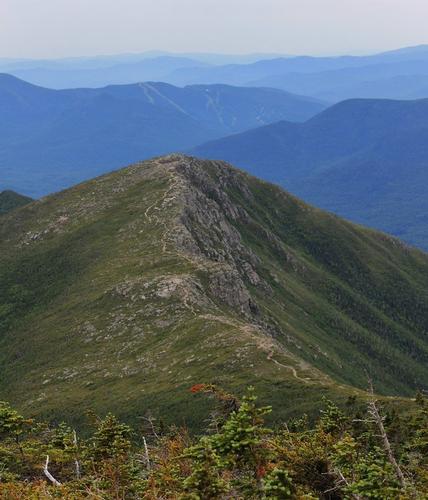
Join me for one of the White Mountains most picturesque loop hikes – the Pemi Loop. This trip will be incredibly rewarding but it will not be without effort. The hike will take us over the famed Bonds, South Twin, Galehead, Garfield, Lafayette, Lincoln, Liberty and Flume. Over the course of two days and one early evening of hiking we will tackle 10 summits – that is some serious peak bagging! To join this trip you must have climbed some 5,000 footers, previously backpacked for at least one overnight summiting and descending with your full pack and have experience above tree line. The overall trip is approximately 34 miles.
We will meet at Lincoln Woods in Lincoln, NH at 4pm on Friday. Be ready to hit the trail at 4:15pm. Our hike will begin along the flat, long and serene path that used to be a railroad bed. We will hike to Black Brook where the Bondcliff Trail turns northerly to begin the ascent up the bonds. Depending on the time of day we may opt to hike up further into the wilderness before setting camp for the evening. On this adventure, flexibility is a must. We will secure a campsite near a water source for dinner and breakfast. Black Brook and the Bondcliff trail flirt with one another much of the way up to Bondcliff and there are some sweet camping spots along the ascent. Evening #1 mileage will be in the 4 to 6 mile range.
Saturday, day #1, we’ll break camp early and be on the trail by 8am. We’ll fuel up with a hearty breakfast, hydrate and carry our full water bottles. Because water can be tricky along this circuit, I will advise that you fill your water bottles whenever the opportunity presents itself. The Bondcliff trail is a sweet meandering ascent which will bring us to Bondcliff, Mt. Bond and we’ll detour to jaunt to West Bond and back. Shortly after West Bond we will visit the Guyot campsite to replenish water, take a break, snack, etc. From Guyot we will make our way to South Twin and most likely tag Mt. Guyot along the way. The general terrain between Bondcliff and South Twin is a series of modest ups and downs popping in and out of tree line. Stunning to be certain, but don’t underestimate your need for endurance during this section.
The descent from South Twin will be a welcome change of pace. It is an 800 foot drop characterized by stone stairs which I’ve climbed up in fall and winter. We’ll reach Galehead hut where we can rehydrate, drop packs, tag Galehead and return to the hut. From the hut, we’ll ensure full hydration and full water bottles and we’ll carry along the Garfield Ridge Trail and hopefully secure a campsite at Garfield Ridge Camp Site. Day two mileage will be in the range of 13 to 15 miles depending on where we ultimately camp. Water sources, while available, can be tricky and that will ultimately drive where we camp on evening #2.
Sunday, day #2, we’ll break camp early and be on the trail by 8:30am. Yep – we’ll give ourselves an extra half hour, lol. It will be super important to be fully hydrateded with full water bottles as the next anticipated water source will be Liberty Springs. The trail from Garfield Ridge Camp Site to the summit of Mt. Lafayette is a brilliant and strenuous stretch. From the summit of Lafayette it’s all downhill from there. (Not exactly really but given what we will have achieved, yes it is!!). We’ll scoot over to Mt. Lincoln then on to Liberty Springs. At the trail junction for Liberty Springs Trail and Franconia Ridge Trail we’ll drop packs and scoot down to Liberty Springs to rehydrate. We’ll scoot back up and make our way over to Mt. Flume – our final peak of the adventure – and then begin the final 4.1 mile descent to rejoin the Lincoln Woods Trail. From the junction its 1.4 miles of flat and easy meandering back to the cars. Overall mileage on day #2 will be in the range of 13 to 15 miles.
This trip is weather dependent. A significant amount of time is spent above tree line hiking magnificent ridges – it truly is spectacular. A lot of effort goes into planning such a trip and I know the disappointment of a cancellation, however, the experience for me is in the views, partly sunny weather and reasonably dry conditions with no threat of thunder. All that is a tall order for early July. A forecast that includes a burst of showers will not cancel but a forecast that indicates sustained rainfall and strong likelihood of thunder will. In all instances, be prepared for adverse weather conditions. In the event of unforeseen weather conditions there are many exit strategies along the path. They will not, however, include linking us back to our cars. A small problem to contend with should that rare moment occur.
For this trip you will need a tent, bivy or hammock; head lamp; stove; utensils; lighter; sleeping bag, all the essentials of a classic backpacking trip. Bring two sets of hiking clothing, including pants (which are usually convertible to shorts). You will need a rain coat as a precaution and bring light fleece layers in case the day temperatures unexpectedly turn chilly. You may also benefit from sun screen, bug spray, ball cap or brim hat – some sun protection. You will need dinner for Friday evening, Breakfast, lunch and dinner on Saturday, Breakfast and lunch for Sunday. Ensure a hearty supply of snacks to fuel you in between meals. I will recommend three liter bottles of water.
For Sunday – Soleil – my puppy – is booked into the kennel through Monday morning. Bring a towel and a change of clothes. Rest assured – I will be scouting a swimming hole along the East Branch of the Pemigewasset River for a refreshing dip. That is my reward post hike. Late afternoon on Sunday will ensure some privacy as well – me likes to get really clean!! Depending on the time of day we conclude the hike – we might possibly grab dinner before heading home as well.
I'm not sure about camping fees at the Garfield Camp site - bring a few ten's in the event we are charged to overnight. We can also opt to hike on for a more primitive experience.
Cheers gents – see you on the trail.
Directions
The Lincoln Woods trail head is located at the Lincoln Woods Visitor Center off of route 112 also known as the Kancamagus Highway. From route 93 North or Southbound take exit 32 and travel east. The center is a few miles beyond Loon Mountain Ski Resort. While this parking lot tends to fill up fast on weekends I am hoping for ample space. There is a fee for parking so bring singles. Last known fee was $3 per day so a flat $10 will cover you and you'll have donated an extra buck to the upkeep of the National Forests.
About this event
Join me for one of the White Mountains most picturesque loop hikes – the Pemi Loop. This trip will be incredibly rewarding but it will not be without effort. The hike will take us over the famed Bonds, South Twin, Galehead, Garfield, Lafayette, Lincoln, Liberty and Flume. Over the course of two days and one early evening of hiking we will tackle 10 summits – that is some serious peak bagging! To join this trip you must have climbed some 5,000 footers, previously backpacked for at least one overnight summiting and descending with your full pack and have experience above tree line. The overall trip is approximately 34 miles.
We will meet at Lincoln Woods in Lincoln, NH at 4pm on Friday. Be ready to hit the trail at 4:15pm. Our hike will begin along the flat, long and serene path that used to be a railroad bed. We will hike to Black Brook where the Bondcliff Trail turns northerly to begin the ascent up the bonds. Depending on the time of day we may opt to hike up further into the wilderness before setting camp for the evening. On this adventure, flexibility is a must. We will secure a campsite near a water source for dinner and breakfast. Black Brook and the Bondcliff trail flirt with one another much of the way up to Bondcliff and there are some sweet camping spots along the ascent. Evening #1 mileage will be in the 4 to 6 mile range.
Saturday, day #1, we’ll break camp early and be on the trail by 8am. We’ll fuel up with a hearty breakfast, hydrate and carry our full water bottles. Because water can be tricky along this circuit, I will advise that you fill your water bottles whenever the opportunity presents itself. The Bondcliff trail is a sweet meandering ascent which will bring us to Bondcliff, Mt. Bond and we’ll detour to jaunt to West Bond and back. Shortly after West Bond we will visit the Guyot campsite to replenish water, take a break, snack, etc. From Guyot we will make our way to South Twin and most likely tag Mt. Guyot along the way. The general terrain between Bondcliff and South Twin is a series of modest ups and downs popping in and out of tree line. Stunning to be certain, but don’t underestimate your need for endurance during this section.
The descent from South Twin will be a welcome change of pace. It is an 800 foot drop characterized by stone stairs which I’ve climbed up in fall and winter. We’ll reach Galehead hut where we can rehydrate, drop packs, tag Galehead and return to the hut. From the hut, we’ll ensure full hydration and full water bottles and we’ll carry along the Garfield Ridge Trail and hopefully secure a campsite at Garfield Ridge Camp Site. Day two mileage will be in the range of 13 to 15 miles depending on where we ultimately camp. Water sources, while available, can be tricky and that will ultimately drive where we camp on evening #2.
Sunday, day #2, we’ll break camp early and be on the trail by 8:30am. Yep – we’ll give ourselves an extra half hour, lol. It will be super important to be fully hydrateded with full water bottles as the next anticipated water source will be Liberty Springs. The trail from Garfield Ridge Camp Site to the summit of Mt. Lafayette is a brilliant and strenuous stretch. From the summit of Lafayette it’s all downhill from there. (Not exactly really but given what we will have achieved, yes it is!!). We’ll scoot over to Mt. Lincoln then on to Liberty Springs. At the trail junction for Liberty Springs Trail and Franconia Ridge Trail we’ll drop packs and scoot down to Liberty Springs to rehydrate. We’ll scoot back up and make our way over to Mt. Flume – our final peak of the adventure – and then begin the final 4.1 mile descent to rejoin the Lincoln Woods Trail. From the junction its 1.4 miles of flat and easy meandering back to the cars. Overall mileage on day #2 will be in the range of 13 to 15 miles.
This trip is weather dependent. A significant amount of time is spent above tree line hiking magnificent ridges – it truly is spectacular. A lot of effort goes into planning such a trip and I know the disappointment of a cancellation, however, the experience for me is in the views, partly sunny weather and reasonably dry conditions with no threat of thunder. All that is a tall order for early July. A forecast that includes a burst of showers will not cancel but a forecast that indicates sustained rainfall and strong likelihood of thunder will. In all instances, be prepared for adverse weather conditions. In the event of unforeseen weather conditions there are many exit strategies along the path. They will not, however, include linking us back to our cars. A small problem to contend with should that rare moment occur.
For this trip you will need a tent, bivy or hammock; head lamp; stove; utensils; lighter; sleeping bag, all the essentials of a classic backpacking trip. Bring two sets of hiking clothing, including pants (which are usually convertible to shorts). You will need a rain coat as a precaution and bring light fleece layers in case the day temperatures unexpectedly turn chilly. You may also benefit from sun screen, bug spray, ball cap or brim hat – some sun protection. You will need dinner for Friday evening, Breakfast, lunch and dinner on Saturday, Breakfast and lunch for Sunday. Ensure a hearty supply of snacks to fuel you in between meals. I will recommend three liter bottles of water.
For Sunday – Soleil – my puppy – is booked into the kennel through Monday morning. Bring a towel and a change of clothes. Rest assured – I will be scouting a swimming hole along the East Branch of the Pemigewasset River for a refreshing dip. That is my reward post hike. Late afternoon on Sunday will ensure some privacy as well – me likes to get really clean!! Depending on the time of day we conclude the hike – we might possibly grab dinner before heading home as well.
I'm not sure about camping fees at the Garfield Camp site - bring a few ten's in the event we are charged to overnight. We can also opt to hike on for a more primitive experience.
Cheers gents – see you on the trail.
Directions to the trailhead
Get directionsThe Lincoln Woods trail head is located at the Lincoln Woods Visitor Center off of route 112 also known as the Kancamagus Highway. From route 93 North or Southbound take exit 32 and travel east. The center is a few miles beyond Loon Mountain Ski Resort. While this parking lot tends to fill up fast on weekends I am hoping for ample space. There is a fee for parking so bring singles. Last known fee was $3 per day so a flat $10 will cover you and you'll have donated an extra buck to the upkeep of the National Forests.
Who's going (3)


Questions about this event?
Log in to see who's hosting and to ask them questions in the event discussion.
Log in
Event discussion
No comments yet.
Log in to join the conversation.