
Chesterfield Gorge (Mass.) Hike
Chesterfield Gorge Hike (western Mass.)
The trip report
Written by TomKerner · last updated by swimfit on Aug 9, 2021
From the Trustees of Reservations parking lot we took the path next to the gorge downstream until it connected to the dirt road; then continued downstream past the second (flatwater) gorge; there the road ran next to swampy river bottom with hordes of mosquitoes, so we decided to head back upstream for lunch break at a small promintory overlooking the river; afterward, we headed back up to the parking lot & dispersed from there.
Total miles: about 9 3/4 along gently sloping road with minor elevation gains.
The road runs about 7 miles from Chesterfield Gorge to Knightville Dam with minimal motorized traffic - perhaps a venue for a future bicycle ride.
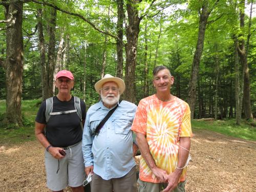
Event photos (1)
Reactions
Log in to react to this trip report.
About this event
Meet at parking lot; walk along trail next to the gorge until the trail meets the road. Walk on dirt road about 4 miles downstream. Have lunch next to the Westfield River, then return by same route to the parking lot. Some minor elevation gains on the road - maybe 50 feet maiximum. Road is mostly tree-shaded.
For details on the gorge, Google: Chesterfield Gorge - The Trustees of Reservations
Dinner afterward at Tom's house in Chicopee for anyone who is interested.
Please let me know if you would like to carpool. I'll leave my house about 9:00 AM.
For anyone coming out by train or bus, I can pick you up at the Springfield Travel Center.


Comments
No comments yet.
Log in to join the conversation.