
Bartram Trail- Wayah Bald to Appletree Campground
A pleasant mostly down hill 12.42 mile hike
The trip report
Written by dnaturist
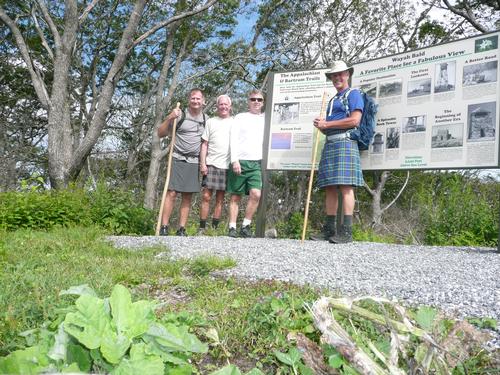
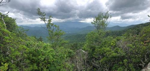
The hike started from the Wayah Bald observation tower. The tower had a new roof and new information plaques constructed after the fires of 20 months ago..
The first half of the hike was a downhill walk down to Lake Nantahala. From here we had a 0.7 road walk alont the lake, on Wayah Road. On the road we came across a lakes side grill, and stopped for lunch and cold drinks. One of the hikers came up lame and stayed here, lakeside, as we continued our hike..
The remainder of the hike was pretty much up and down, with the last 2 miles following the High Water Trail Rd. (gravel road). This road paralled the river most of the way.
We had pleasant weather with nice breezes most of the way.
Event photos (5)
Reactions
Log in to react to this trip report.
About this event
This 12.9 mile hike will be through the Nantahala National Forest and start at Wayah Bald (our highest point at 5342 ft.) and be mostly down hill to Appletree Camground at the Nantahalla River.
At Wayah Bald there is a stone obervation tower with views of the Smokies, Franklin and the Georgia mountains.
The first two miles of the hike will run concurrent with the Appalachian Trail as the trail winds down to Wine Spring, which will have campsites and water. At the 3.9 mile mark we will come into Sawmill Gap. We will come to Jarret Bald (4820 ft.) at about 4.8 miles into the hike. From here we will have views of Nantahala Lake below. Then a steep descent begins on switchbacks that takes us to Wayah Road.
We will have a .7 mile walk along the lake on Wayah Road. We shall walk north along the road until we reach a Phillips 66 gas station. The trail then takes to a gravel road. The remainder of the hike will be on old logging roads and some gravel roads. One of which will be the High Water Trail Road, which parallels the Nantahala River.
This will be a one-way hike, so we will be doing a car shuttle.
Plan to spend 7 hours on the trail.
We plan to leave the morning meeting place, for the trailheads at 8:30 AM sharp.
Who came along (2)
 GUEST MEMBER
  GUEST MEMBER
Comments
Log in to join the conversation.