
The trip report
No write-up was added for this event.
Reactions
Log in to react to this trip report.
About this event
Date: April 9, 2011
Time: 9:30 am
Near: Calabasas, CA
Distance: 7 miles round trip
Elevation: 1000 ft (Calabasas Peak)
Hike Time: 4 1/2 hours
Difficulty: Moderate
Trail Type: Fire road/trail
Hike Type: Out and Back
Lat/Lon: 34.11200°N / 118.651°W
Highlights: Beautiful mountain and canyon views (on a clear day), sculpted and unusual tilted rock formations.
Calabasas Peak
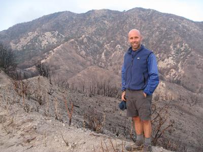
Summary: Calabasas Peak towers over Red Rock Canyon, Old Topanga Canyon and bowl- shaped Cold Creek Canyon This hike gives you a good cardio workout, with a moderate but steady uphill trek for a little less than 2 miles to the summit of Calabasas Peak. The route to the 2163-foot peak follows a graded fire road with a 1000’ elevation gain. The views along the way are wonderful. Off to the left are great vistas of the Santa Monica Mountains across a lovely small valley. As you ascend to the peak, along the right are spectacular tilted and pocketed sandstone formations. Over the crest, Red Rock Canyon comes into view on the right. From the top, one can see north into Ventura County, southwest to the Pacific Ocean and northeast to the San Fernando and Simi valleys. The Calabasas Peak Trail passes a variety of interesting geological formations, such as large weathered sandstone outcroppings and colorful rock slabs.
Who came along (1)
 GUEST MEMBER
Comments
No comments yet.
Log in to join the conversation.