
Nancy Brook and Norcross Pond
Fall Foliage Exploration
Details
Nancy Brook and Norcross Pond: elevation (highest point) 3120ft, distance to highest point 4.3 miles, total trip distance 8.6.
This trip is considered MODERATE. Some steep grade and distance are factors.
Group will meet at 8 am and depart up the trail at 8:20 am SHARP.
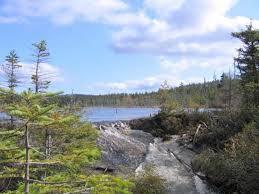
Hike begins on Route 302 Harts Location. The first half of this hike is a gradual grade up to Nancy Cascades. Passing the remains of an old logging camp. Leaving the cascades is a steep switch back for about .5 a mile. The trail then resumes a gentle grade through a moss-covered virgin forest, traveling along the Nancy Brook. Eventually reaching Nancy Pond the trail will wind around though forest and bog. Reaching the outlet of Norcross Pond and an amazing view of The Pemigewasset Wilderness.
PREPARATION/WHAT TO BRING: White Mountains can have unpredictable and extreme weather changes year-round. It is recommended that hikers have extra dry clothing and wind protection. Always have water (no guarantee for places to refill) and food. If you need suggestions on what to bring, PLEASE ASK!! It is also highly recommended to bring a BLISTER KIT (DIY kits online). If this is the first hike of the season or brand-new footwear, foot first aid most likely will be necessary.
For this trip it is important to bring along flexibility, patience, and a sense of humor.
Group Size: It is not fun leaving folks out of trips. If you cannot attend, PLEASE cancel so others may join. If you are on the waiting list, please contact me days prior to the trip, most likely there is room.
Dogs are the FULL responsibility of the owner and cannot interfere with the hike or the participants. This hike may not be ideal for dogs because of other dogs and hikers. This trail is narrow and steep. It is up to the owner. A leash (close at hand) is highly recommended (also required in WMNF). Decreasing the impact to the environment is always a priority! Please plan to “carry in and carry out” all items. It may also be possible to collect other hikers’ debris along the way.
Weather: If weather is a concern any updates or cancellation information will be posted by the Thursday prior by 6pm. If it is a cancellation it will include a rescheduled date so participants can watch for that opportunity.
Safety is a priority! Any time a hiker is injured or lost a HUGE team of volunteers is dispatched to aid in the search and rescue efforts. No one wants to be injured or put other in harms way. Always be prepared. Know your limits. Any questions feel free to contact me.
Group will meet at 8 am and depart up the trail at 8:20 am Sharp.
Directions
Group will meet at 8 am and depart up the trail at 8:20 am Sharp.
Where to meet: At the trail head parking area along Route 302 in Harts Location. The Trail parking is on the south side of the road. The trail head is 9.5 miles east from the AMC Highland Center and 5.2 miles west of Bartlett Village. Notchland Inn is less then a mile west of the trail head.
Because of trip preparation the trip leader is unable to provide a ride for this trip.
Cell service is inconsistent. GPS will get you your quickest route to the trailhead.
About this event
Nancy Brook and Norcross Pond: elevation (highest point) 3120ft, distance to highest point 4.3 miles, total trip distance 8.6.
This trip is considered MODERATE. Some steep grade and distance are factors.
Group will meet at 8 am and depart up the trail at 8:20 am SHARP.
Hike begins on Route 302 Harts Location. The first half of this hike is a gradual grade up to Nancy Cascades. Passing the remains of an old logging camp. Leaving the cascades is a steep switch back for about .5 a mile. The trail then resumes a gentle grade through a moss-covered virgin forest, traveling along the Nancy Brook. Eventually reaching Nancy Pond the trail will wind around though forest and bog. Reaching the outlet of Norcross Pond and an amazing view of The Pemigewasset Wilderness.
PREPARATION/WHAT TO BRING: White Mountains can have unpredictable and extreme weather changes year-round. It is recommended that hikers have extra dry clothing and wind protection. Always have water (no guarantee for places to refill) and food. If you need suggestions on what to bring, PLEASE ASK!! It is also highly recommended to bring a BLISTER KIT (DIY kits online). If this is the first hike of the season or brand-new footwear, foot first aid most likely will be necessary.
For this trip it is important to bring along flexibility, patience, and a sense of humor.
Group Size: It is not fun leaving folks out of trips. If you cannot attend, PLEASE cancel so others may join. If you are on the waiting list, please contact me days prior to the trip, most likely there is room.
Dogs are the FULL responsibility of the owner and cannot interfere with the hike or the participants. This hike may not be ideal for dogs because of other dogs and hikers. This trail is narrow and steep. It is up to the owner. A leash (close at hand) is highly recommended (also required in WMNF). Decreasing the impact to the environment is always a priority! Please plan to “carry in and carry out” all items. It may also be possible to collect other hikers’ debris along the way.
Weather: If weather is a concern any updates or cancellation information will be posted by the Thursday prior by 6pm. If it is a cancellation it will include a rescheduled date so participants can watch for that opportunity.
Safety is a priority! Any time a hiker is injured or lost a HUGE team of volunteers is dispatched to aid in the search and rescue efforts. No one wants to be injured or put other in harms way. Always be prepared. Know your limits. Any questions feel free to contact me.
Group will meet at 8 am and depart up the trail at 8:20 am Sharp.
Directions to the trailhead
Get directionsGroup will meet at 8 am and depart up the trail at 8:20 am Sharp.
Where to meet: At the trail head parking area along Route 302 in Harts Location. The Trail parking is on the south side of the road. The trail head is 9.5 miles east from the AMC Highland Center and 5.2 miles west of Bartlett Village. Notchland Inn is less then a mile west of the trail head.
Because of trip preparation the trip leader is unable to provide a ride for this trip.
Cell service is inconsistent. GPS will get you your quickest route to the trailhead.
Who's going (4)
 GUEST MEMBER
  GUEST MEMBER
  GUEST MEMBER
  GUEST MEMBER
 Questions about this event?
Reach out to the host, nhclimber03264, for route details, carpooling, or what to bring.
Email the hostYou can also ask in the event discussion below.
Event discussion
No comments yet.
Log in to join the conversation.