
9/11 Memorial Hike
Memorial Adventure on Moosilauke
Details
“I went to the woods because I wished to live deliberately, to front only the essential facts of life, and see if I could not learn what it had to teach, and not, when I came to die, discover that I had not lived.” — Henry David Thoreau, Walden.
September 9th 2023 – Flags on the 48
Mt Moosilauke Loop: Via the Beaver Brook and Benton Trails.
- Elevation (highest point) 4817ft – Mt Moosilauke
- Distance to highest point 3.3 miles
- Total trip distance 6.4 miles.
https://www.alltrails.com/explore/map/mt-moosilauke-beaver-and-benton-8ede06e
This trip is considered STRENUOUS.
- Steep grade (up),
- distance,
- pace (consistent and steady),
- exposure, weather and possible winter conditions.
- A portion of this trip is exposed above tree line, there is no shelter or alternate routes.
Group will meet at the Beaver Brook Parking area located on route 112 at 8am and depart by 8:20.
Trail Details and Distances:
The Beaver Brook trail is a steep access to Moosilauke and affords amazing views and access to several waterfalls. Trail will level out once reaching the ridge. If time and weather allow the trip may include the search for a WWII bomber that crashed near the summit. This hike also is scheduled as a memorial to September 11th and many people will gather to mark the occasion. Group will travel down the Benton Trail which is far more gentler than the Beaver Brook ascent.
PREPARATION/WHAT TO BRING: White Mountains can and do have unpredictable and extreme weather changes year-round. Do not be fooled by lower elevation weather. Weather in higher elevations can be very tricky and unstable. A major portion of this trip is exposed above tree line, there is no shelter or water access.
It is recommended that hikers:
- Have extra dry clothing, sun, and wind protection.
- Minimum of 2 liters of water
- Expect possible winter conditions.
- If you need suggestions on what to bring, PLEASE ASK!!
For this trip it is important to bring along flexibility, patience, and a sense of humor.
Group Size: It is not fun leaving folks out of trips.
- PLEASE cancel so others may join. If you are on the waiting list, please contact me the days prior to the trip, most likely there is room and if needed this trail will allow us to break the group into smaller groups.
- Decreasing the impact to the environment is always a priority! Above tree line it is vital to stick to the paths and rocks. Do not stray.
- Please plan to “carry in and carry out” all items. It may also be possible to collect other hikers’ debris along the way.
Weather: The weather for this trip will be monitored the week prior. If it is a concern any updates or cancellation information will be posted by the Friday prior by 6pm. If it is a cancellation, it will include a rescheduled date so participants can watch for that opportunity.
For weather details;
- (NH) Mt Washington Observatory www.mountwashington.org
- (VT) Fairbanks Museum www.fairbanksmuseum.org/eye-on-the-sky
- National Weather Service – NOAA www.weather.gov
- (GA) Weather www.weather.com
Safety is a priority! Any time a hiker is injured or lost a HUGE team of volunteers is dispatched to aid in the search and rescue efforts.
- No one wants to be injured or put other in harm’s way.
- Always be prepared. Know your limits.
- Any questions feel free to contact trip leader DIRECTLY.
After trip social: Social gathering is possible and welcome. There are several food and beverage options. Pizza and tail gate gathering could be arranged if folks wish to do so. Discussion is open to possible overnight arrangements.
Resources used to plan this trip:
- AMC White Mountain Guide, 30th addition.
- Alltrails.com (see link above)
- US Forest Service www.usfs.gov
- NH Fish and Game www.wildlife.state.nh.us
- NH State Parks www.nhstateparks.org
Group will meet at the Beaver Brook Parking area located on route 112 at 8am and depart by 8:20.
Directions
Group will meet at the Beaver Brook Parking area located on route 112 at 8am and depart by 8:20.
Where to meet: Trail head is approximately 6 miles west of Lincoln NH (Exit 32)
If you need a food, fuel or bathroom stop Exit 26, on Route 25 is an Irving station with food and fuel. Be advised that prices will be affordable compared to Lincoln NH
**Because of trip preparation the trip leader is unable to provide a ride for this trip.
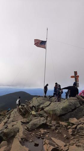
About this event
“I went to the woods because I wished to live deliberately, to front only the essential facts of life, and see if I could not learn what it had to teach, and not, when I came to die, discover that I had not lived.” — Henry David Thoreau, Walden.
September 9th 2023 – Flags on the 48
Mt Moosilauke Loop: Via the Beaver Brook and Benton Trails.
- Elevation (highest point) 4817ft – Mt Moosilauke
- Distance to highest point 3.3 miles
- Total trip distance 6.4 miles.
https://www.alltrails.com/explore/map/mt-moosilauke-beaver-and-benton-8ede06e
This trip is considered STRENUOUS.
- Steep grade (up),
- distance,
- pace (consistent and steady),
- exposure, weather and possible winter conditions.
- A portion of this trip is exposed above tree line, there is no shelter or alternate routes.
Group will meet at the Beaver Brook Parking area located on route 112 at 8am and depart by 8:20.
Trail Details and Distances:
The Beaver Brook trail is a steep access to Moosilauke and affords amazing views and access to several waterfalls. Trail will level out once reaching the ridge. If time and weather allow the trip may include the search for a WWII bomber that crashed near the summit. This hike also is scheduled as a memorial to September 11th and many people will gather to mark the occasion. Group will travel down the Benton Trail which is far more gentler than the Beaver Brook ascent.
PREPARATION/WHAT TO BRING: White Mountains can and do have unpredictable and extreme weather changes year-round. Do not be fooled by lower elevation weather. Weather in higher elevations can be very tricky and unstable. A major portion of this trip is exposed above tree line, there is no shelter or water access.
It is recommended that hikers:
- Have extra dry clothing, sun, and wind protection.
- Minimum of 2 liters of water
- Expect possible winter conditions.
- If you need suggestions on what to bring, PLEASE ASK!!
For this trip it is important to bring along flexibility, patience, and a sense of humor.
Group Size: It is not fun leaving folks out of trips.
- PLEASE cancel so others may join. If you are on the waiting list, please contact me the days prior to the trip, most likely there is room and if needed this trail will allow us to break the group into smaller groups.
- Decreasing the impact to the environment is always a priority! Above tree line it is vital to stick to the paths and rocks. Do not stray.
- Please plan to “carry in and carry out” all items. It may also be possible to collect other hikers’ debris along the way.
Weather: The weather for this trip will be monitored the week prior. If it is a concern any updates or cancellation information will be posted by the Friday prior by 6pm. If it is a cancellation, it will include a rescheduled date so participants can watch for that opportunity.
For weather details;
- (NH) Mt Washington Observatory www.mountwashington.org
- (VT) Fairbanks Museum www.fairbanksmuseum.org/eye-on-the-sky
- National Weather Service – NOAA www.weather.gov
- (GA) Weather www.weather.com
Safety is a priority! Any time a hiker is injured or lost a HUGE team of volunteers is dispatched to aid in the search and rescue efforts.
- No one wants to be injured or put other in harm’s way.
- Always be prepared. Know your limits.
- Any questions feel free to contact trip leader DIRECTLY.
After trip social: Social gathering is possible and welcome. There are several food and beverage options. Pizza and tail gate gathering could be arranged if folks wish to do so. Discussion is open to possible overnight arrangements.
Resources used to plan this trip:
- AMC White Mountain Guide, 30th addition.
- Alltrails.com (see link above)
- US Forest Service www.usfs.gov
- NH Fish and Game www.wildlife.state.nh.us
- NH State Parks www.nhstateparks.org
Group will meet at the Beaver Brook Parking area located on route 112 at 8am and depart by 8:20.
Directions to the trailhead
Get directionsGroup will meet at the Beaver Brook Parking area located on route 112 at 8am and depart by 8:20.
Where to meet: Trail head is approximately 6 miles west of Lincoln NH (Exit 32)
If you need a food, fuel or bathroom stop Exit 26, on Route 25 is an Irving station with food and fuel. Be advised that prices will be affordable compared to Lincoln NH
**Because of trip preparation the trip leader is unable to provide a ride for this trip.
Who's going (5)
 GUEST MEMBER
  SUSTAINING
  SUSTAINING
  GUEST MEMBER
  GUEST MEMBER
 Questions about this event?
Reach out to the host, nhclimber03264, for route details, carpooling, or what to bring.
Email the hostYou can also ask in the event discussion below.
Event discussion
Two updates!
I. Bod has recently (last week) tested positive for Covid. He is feeling fine now and is currently headed to Baxter State Park. He is planning on hiking Katahdin on Wednesday. He will check in on Thursday when he returns to NH. The symptoms and risks may have passed but I wanted you to know. Once he is back in NH from his Maine adventure, he will test again to make sure he is still negative.
Thanks
JT
II. The weather! Please keep an eye on the weather expected for this weekend. Right now it is looking grim and it has the potential to interfere with our hike. It is too early to tell for sure and I am asking you all to think about other options, such as another hike, changing to Sunday (also not looking good), or canceling altogether. These are just thoughts right now. We have a few days to see if Mother Nature will play nice.
Thanks
JT
Log in to join the conversation.