
Mt. Moosilauke Hike
Beautiful Hike Up To Mount Moosilauke
Details
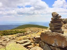
Mt. Moosilauke is the westernmost of NH's four thousand footers. It has also one of the largest alpine zones of the northeast around its 4,802 foot summit. On a clear day the views are unparalleled, and the sharp eyed can make much of the detail of Vermont's highest peaks in the distance. We plan to do a loop hike, starting at the Dartmouth Outing Club's Ravine Lodge, up the Gorge Brook Trail, and down the Carriage Road Trail, for a total of 8.3 miles. The grades are generally moderate, and this is a relatively less strenuous way to make it up and down to the summit. However, please note that this is nevertheless a somewhat strenuous hike, and that we will be exposed to the elements around the summit. So please bring weather and wind proof gear, sturdy hiking boots, at least two liters of water, lunch, and plenty of snacks. Rain will cancel.
Directions
Parking around the Ravine Lodge is at a premium, so we will meet at the Hannaford parking lot in Plymouth, NH, and carpool from there. Please try to be there by 9:00 a.m. sharp, as it will still take a bit over a half hour to get to the trailhead. To get to the Hannaford's, take exit 26 off I-93, then down the Tenney Hwy, to the first traffic light by the gas station, Dunkin Donut, etc. Turn left for the Hannaford Plaza, drive over towards the Marshalls store (away from the supermarket crowd), and we will meet there. If you prefer to drive directly to the Lodge, please let me know, so that we can make arrangements to meet up there. It is ok to leave cars in this parking lot.
About this event
Mt. Moosilauke is the westernmost of NH's four thousand footers. It has also one of the largest alpine zones of the northeast around its 4,802 foot summit. On a clear day the views are unparalleled, and the sharp eyed can make much of the detail of Vermont's highest peaks in the distance. We plan to do a loop hike, starting at the Dartmouth Outing Club's Ravine Lodge, up the Gorge Brook Trail, and down the Carriage Road Trail, for a total of 8.3 miles. The grades are generally moderate, and this is a relatively less strenuous way to make it up and down to the summit. However, please note that this is nevertheless a somewhat strenuous hike, and that we will be exposed to the elements around the summit. So please bring weather and wind proof gear, sturdy hiking boots, at least two liters of water, lunch, and plenty of snacks. Rain will cancel.
Directions to the trailhead
Get directionsParking around the Ravine Lodge is at a premium, so we will meet at the Hannaford parking lot in Plymouth, NH, and carpool from there. Please try to be there by 9:00 a.m. sharp, as it will still take a bit over a half hour to get to the trailhead. To get to the Hannaford's, take exit 26 off I-93, then down the Tenney Hwy, to the first traffic light by the gas station, Dunkin Donut, etc. Turn left for the Hannaford Plaza, drive over towards the Marshalls store (away from the supermarket crowd), and we will meet there. If you prefer to drive directly to the Lodge, please let me know, so that we can make arrangements to meet up there. It is ok to leave cars in this parking lot.
Who's going (4)
 SUSTAINING
  SUSTAINING
  SUSTAINING
  GUEST MEMBER
 Questions about this event?
Reach out to the host, JPHiker, for route details, carpooling, or what to bring.
Email the hostYou can also ask in the event discussion below.
Event discussion
Log in to join the conversation.