
Mts. Washington and Monroe Hike
This is a big hike up the highest peak in the Northeast and we are adding in Mt. Monroe for good measure!
Mts. Washington and Monroe Hike
This is a big hike up the highest peak in the Northeast and we are adding in Mt. Monroe for good measure!
Details
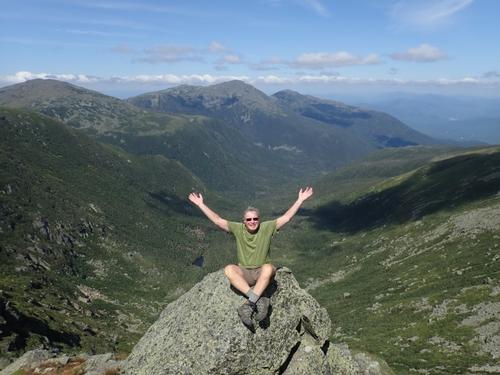
This is a big hike up the highest peak in the Northeast and we are adding in Mt. Monroe for good measure! There will be plenty of time above treeline and no shortage of views! Mt. Washington is at 6,288 feet and Mt. Monroe at 5,384 feet.
Stats
Difficulty: Very Strenuous
Distance: 9.8 miles
Elevation Gain: 4,150 feet
Time: 8-9 hours
Itinerary
Start: Cog Railway Base Station Parking Lot
Ammonoosuc Trail
Crawford Path
Mt. Monroe Loop
Mt. Monroe Summit [5,384 ft.]
Crawford Path
Mt. Washington Summit [6,288 ft.]
Gulfside Trail
Jewell Trail
End: Cog Railway Base Station Parking Lot
This route to Mount Washington takes us up the steep and scenic Ammonoosuc Ravine. Just above treeline, the AMC’s Lakes of the Clouds Hut offers shelter, a place to rest and refill water bottles. We’ll hike up Mt. Monroe which is a 350 feet ascent. [If you want to save your energy for Mt. Washington, you can rest here and wait until we return.] Mt. Washington may seem pretty close, but it's another 1,400 foot climb in just 1.5 miles. We'll take the Crawford Path from the Hut and follow it between two little lakes whose stony shores and ledges support alpine plants, sedges and shrubs. The Crawford Path is well worn and marked by cairns, each topped with a yellow-painted rock. The summit can be jarring with tourists, television towers and trains but it does provide magnificent views!
We’ll have lunch inside the summit building where you can buy hot food if you did not bring a lunch. We'll descend using the Gulfside Trail that takes us past the headwall of the awesome Great Gulf, the largest glacial cirque on Mount Washington! We’ll continue our descent down the Jewell Trail which the upper part is composed of rugged slabs; the lower half gets better.
Due to the high elevation and level of exposure, we'll have to be particularly mindful of the weather forecast and adjust our plans if necessary.
Stuff To Bring:
- Non-cotton clothing [synthetics/wool]
- Layers
- Rain Gear
- Proper footwear [hiking shoes/boots]
- At least 2 liters of water [we'll get more water at the Hut]
- Sunscreen/Sunglasses
- Lunch/snacks
After The Hike: Everyone is invited back to our house for a swim in the Mad River and BBQ! It’s BYOB and all we ask is $10 to reimburse us for food costs. You are invited to use our showers and freshen up into clean clothes.
Lodging Option: Bunk beds are available at our house near Waterville Valley, NH for Friday at $25 and/or Saturday night at $35 per night that includes dinner. Coffee/bagels each morning and linen/blankets/towels are provided. We have limited space in the fridge to store your beverages/food so it's best to bring a small cooler. Space is limited so email ASAP to reserve a bunk!
Directions
Leave US 302 at Fabyan and drive on the Base Road 5.5 all the way to the end where you will reach the Cog Railway Base Center. As soon as you arrive, there is a hiker parking lot on the right where you'll have to pay a parking fee. The parking fee is $10 per vehicle so carpooling is encouraged. We are driving a blue Toyota Tacoma truck.
About this event
This is a big hike up the highest peak in the Northeast and we are adding in Mt. Monroe for good measure! There will be plenty of time above treeline and no shortage of views! Mt. Washington is at 6,288 feet and Mt. Monroe at 5,384 feet.
Stats
Difficulty: Very Strenuous
Distance: 9.8 miles
Elevation Gain: 4,150 feet
Time: 8-9 hours
Itinerary
Start: Cog Railway Base Station Parking Lot
Ammonoosuc Trail
Crawford Path
Mt. Monroe Loop
Mt. Monroe Summit [5,384 ft.]
Crawford Path
Mt. Washington Summit [6,288 ft.]
Gulfside Trail
Jewell Trail
End: Cog Railway Base Station Parking Lot
This route to Mount Washington takes us up the steep and scenic Ammonoosuc Ravine. Just above treeline, the AMC’s Lakes of the Clouds Hut offers shelter, a place to rest and refill water bottles. We’ll hike up Mt. Monroe which is a 350 feet ascent. [If you want to save your energy for Mt. Washington, you can rest here and wait until we return.] Mt. Washington may seem pretty close, but it's another 1,400 foot climb in just 1.5 miles. We'll take the Crawford Path from the Hut and follow it between two little lakes whose stony shores and ledges support alpine plants, sedges and shrubs. The Crawford Path is well worn and marked by cairns, each topped with a yellow-painted rock. The summit can be jarring with tourists, television towers and trains but it does provide magnificent views!
We’ll have lunch inside the summit building where you can buy hot food if you did not bring a lunch. We'll descend using the Gulfside Trail that takes us past the headwall of the awesome Great Gulf, the largest glacial cirque on Mount Washington! We’ll continue our descent down the Jewell Trail which the upper part is composed of rugged slabs; the lower half gets better.
Due to the high elevation and level of exposure, we'll have to be particularly mindful of the weather forecast and adjust our plans if necessary.
Stuff To Bring:
- Non-cotton clothing [synthetics/wool]
- Layers
- Rain Gear
- Proper footwear [hiking shoes/boots]
- At least 2 liters of water [we'll get more water at the Hut]
- Sunscreen/Sunglasses
- Lunch/snacks
After The Hike: Everyone is invited back to our house for a swim in the Mad River and BBQ! It’s BYOB and all we ask is $10 to reimburse us for food costs. You are invited to use our showers and freshen up into clean clothes.
Lodging Option: Bunk beds are available at our house near Waterville Valley, NH for Friday at $25 and/or Saturday night at $35 per night that includes dinner. Coffee/bagels each morning and linen/blankets/towels are provided. We have limited space in the fridge to store your beverages/food so it's best to bring a small cooler. Space is limited so email ASAP to reserve a bunk!
Directions to the trailhead
Get directionsLeave US 302 at Fabyan and drive on the Base Road 5.5 all the way to the end where you will reach the Cog Railway Base Center. As soon as you arrive, there is a hiker parking lot on the right where you'll have to pay a parking fee. The parking fee is $10 per vehicle so carpooling is encouraged. We are driving a blue Toyota Tacoma truck.
Who's going (1)
 SUSTAINING
 Questions about this event?
Reach out to the host, Gandalf, for route details, carpooling, or what to bring.
Email the hostYou can also ask in the event discussion below.
Event discussion
No comments yet.
Log in to join the conversation.