
Taconic Crest Trail Traverse
Immerse yourself in Spring
Details
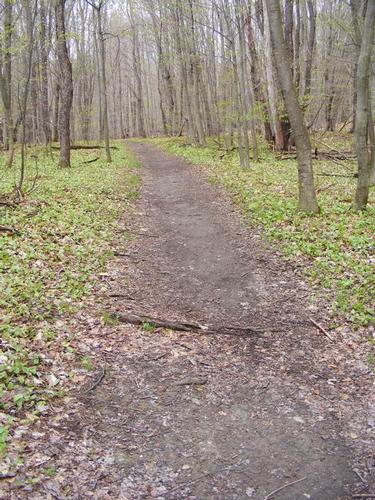
There is no better way to soak in the change of seasons then a nice long walk in the woods. Join us on Saturday May 5th for a traverse of the Taconic Crest Trail along the border of Vermont, New York and Massachusetts! Spring is in full swing in greater Boston and as I journey through my morning commute I get to witness the subtle changes in landscape from Central Massachusetts to suburban Boston. The Berkshires are further west but I’m hoping for the bursting panoply of yellows, reds, lime greens, dark greens, bulbs and other spring flora.
We will meet at the trail head for the Mills Hollow Trail just south of Williamstown, MA along route 43 at 8am. There we will spot a car and carpool north up to the Rosenburg Center where our journey begins at 9:00am. For those that are interested, here is a link to the brief history of the center:
http://hmf.williams.edu/resource-facilities/
We will start off on the Lower Loop Trail and connect with the Upper Loop Trail which will bring us to the junction of Birch Brook trail. Birch Brook Trail ascends 1,000’ but over 1.5 miles of pristine open forest at a very moderate grade. This will be the highest elevation gain of the day as once we are on the ridge, the ups and downs between peaks are modest. We will venture north for a detour to touch Vermont then slip back into New York to visit “Snow Hole”. I led a hike to this destination a few years back. Snow hole is a 40 to 50 foot deep bedrock chasm in limestone. It holds temperatures cold enough to often sustain snow and ice into the summer months – this year, I’m guessing it’s full! I can’t predict what’s there but it will be fun to check it out.
We leave snow hole and double back along the Taconic Crest Trail where we spend the larger part of the day traversing tagging Mt. Raimer at 2,569’ and Mt. Berlin at 2,818’. We carry on over two additional unnamed summits to cross with the Mills Hollow Trail. We follow Mills Hollow down 1.6 miles back to the car.
Overall the day consists of 13 miles of wonderful forest experience. We will have periodic views of eastern New York and Western Ma and providing we have clear skies – views of Mt. Greylock to the east. Depending on group interest we can gather at a local diner for a burger and beer – we will have earned it!
What to bring: Traditional hiking clothes, rain jacket (always be prepared) and preferably no cotton. Two liters of water, lunch and snacks - remember sharing is caring. I don't anticipate the need for traction but I will be bringing my microspikes just as a precaution. The lower elevations have been free of snow and this weeks weather is promising to deliver dryer conditions.
Please note: If you’d like to crash at my home Friday evening to make this hike more feasible – please e-mail me. We will be leaving my home at 5:45am for the 2 hour drive to the trail head.
Directions
If you are coming from the north, south, west or east – you have to find your way to Route 43. Route 43 from the North is off of Route 2/7 just south of Williamstown, MA or Route 7 traveling north from exit 2, the Mass Turnpike. You will take route 43 south/west for a short distance, perhaps up to one mile to the junction of Route 43/Oblong Road. Turn onto Oblong Road. The trail head is less than a ¼ mile from the intersection. Google Maps highlights Oblong Road/Route 43 nicely. I will be driving a dark gray Honda CRV. The meeting time is 8am at the Mills Hollow Trail Head. The hike start time is 9am from the Rosenburg Center.
About this event
There is no better way to soak in the change of seasons then a nice long walk in the woods. Join us on Saturday May 5th for a traverse of the Taconic Crest Trail along the border of Vermont, New York and Massachusetts! Spring is in full swing in greater Boston and as I journey through my morning commute I get to witness the subtle changes in landscape from Central Massachusetts to suburban Boston. The Berkshires are further west but I’m hoping for the bursting panoply of yellows, reds, lime greens, dark greens, bulbs and other spring flora.
We will meet at the trail head for the Mills Hollow Trail just south of Williamstown, MA along route 43 at 8am. There we will spot a car and carpool north up to the Rosenburg Center where our journey begins at 9:00am. For those that are interested, here is a link to the brief history of the center:
http://hmf.williams.edu/resource-facilities/
We will start off on the Lower Loop Trail and connect with the Upper Loop Trail which will bring us to the junction of Birch Brook trail. Birch Brook Trail ascends 1,000’ but over 1.5 miles of pristine open forest at a very moderate grade. This will be the highest elevation gain of the day as once we are on the ridge, the ups and downs between peaks are modest. We will venture north for a detour to touch Vermont then slip back into New York to visit “Snow Hole”. I led a hike to this destination a few years back. Snow hole is a 40 to 50 foot deep bedrock chasm in limestone. It holds temperatures cold enough to often sustain snow and ice into the summer months – this year, I’m guessing it’s full! I can’t predict what’s there but it will be fun to check it out.
We leave snow hole and double back along the Taconic Crest Trail where we spend the larger part of the day traversing tagging Mt. Raimer at 2,569’ and Mt. Berlin at 2,818’. We carry on over two additional unnamed summits to cross with the Mills Hollow Trail. We follow Mills Hollow down 1.6 miles back to the car.
Overall the day consists of 13 miles of wonderful forest experience. We will have periodic views of eastern New York and Western Ma and providing we have clear skies – views of Mt. Greylock to the east. Depending on group interest we can gather at a local diner for a burger and beer – we will have earned it!
What to bring: Traditional hiking clothes, rain jacket (always be prepared) and preferably no cotton. Two liters of water, lunch and snacks - remember sharing is caring. I don't anticipate the need for traction but I will be bringing my microspikes just as a precaution. The lower elevations have been free of snow and this weeks weather is promising to deliver dryer conditions.
Please note: If you’d like to crash at my home Friday evening to make this hike more feasible – please e-mail me. We will be leaving my home at 5:45am for the 2 hour drive to the trail head.
Directions to the trailhead
Get directionsIf you are coming from the north, south, west or east – you have to find your way to Route 43. Route 43 from the North is off of Route 2/7 just south of Williamstown, MA or Route 7 traveling north from exit 2, the Mass Turnpike. You will take route 43 south/west for a short distance, perhaps up to one mile to the junction of Route 43/Oblong Road. Turn onto Oblong Road. The trail head is less than a ¼ mile from the intersection. Google Maps highlights Oblong Road/Route 43 nicely. I will be driving a dark gray Honda CRV. The meeting time is 8am at the Mills Hollow Trail Head. The hike start time is 9am from the Rosenburg Center.
Who's going (4)



Questions about this event?
Log in to see who's hosting and to ask them questions in the event discussion.
Log in
Event discussion
No comments yet.
Log in to join the conversation.