
W Sleeper & Tripyramids Bushwhack
Hiking West Sleeper and the Tripyramids via the Sabbaday Brook, West Sleeper Slide and Pine Bend Brook Trail.
W Sleeper & Tripyramids Bushwhack
Hiking West Sleeper and the Tripyramids via the Sabbaday Brook, West Sleeper Slide and Pine Bend Brook Trail.
Details
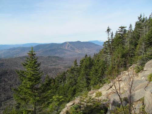
Join me for a hike of the Tripyramids from the east utilizing an easy bushwhack up the West Sleeper Slide. The approach will be via the Sabbaday Brook Trail. Note: As the parking area and the area around the falls are currently closed, we will need to bushwhack a short distance through open woods to the trail. The trail, itself, has minimal grade, but there are a few water crossings. About halfway up the trail, we will leave it for an old logging road, which will take us most of the way to the West Sleeper Slide. This wide, open slide is not overly steep and provides nice views back towards Potash Mountain and Mt. Passaconaway. The bushwhack from the slide to West Sleeper Mountain (3881') is also very open. After reaching the summit we will once again be on a trail. Prior to the summit of South Tripyramid (4100') we will climb the upper section of the South Slide. This is steep, but manageable. The traverse across Middle and North Tripyramids (4140'/4180') has short steep sections, and the summits provide views over Waterville Valley and over to Whiteface and Passaconaway (and on clear days up to the Presidential Range). We will wrap up the hike by descending the modest Pine Bend Brook Trail.
Total Distance and Elevation Gain: Approximately 10.1 miles with about 3620 feet in cumulative elevation gain.
Total Time: 7-8 hours depending on breaks and group's speed.
Rain or harsh weather may postpone to another date or cancel, as appropriate.
What to Bring: Typical early-spring hiking gear should be appropriate: convertible hiking pants, good sturdy hiking boots with thick socks, a windbreaker/raingear and extra layers (e.g. fleece)...or winter jacket/parka depending on forecasted conditions. You should also bring along microspikes and possibly carry snowshoes, just in case. Also bring along lunch, snacks and plenty of water (at least 2-L). Optionally, pack sunscreen and anything else that you may require for a day hike.
Carpooling: Contact other participants or the trip leader to arrange for a rideshare to the trailhead.
Afterwards: If there is sufficient interest, we will have drinks and/or dinner in the Lincoln/North Woodstock area.
Directions
We will meet up at the Pine Bend Brook Trailhead and then carpool to the Sabbaday Brook. From Exit 32 on Route 93 for Lincoln, drive 18.7 miles east along the Kancamagus Highway (Route 112). From the Route 112/113 junction in Conway, travel 16.4 miles to the west along the Kancamagus Highway. There is no parking lot for this trailhead, but there will be a sign along the road. Parking is along the road. The shoulder near the trailhead is wide and is normally well-plowed for hikers. Look for a gray Hyundai Elantra.
For GPS Users: Kancamagus Highway (Rt. 112), Lincoln, NH (44.001649, -71.412275). To obtain custom directions, copy and paste the GPS coordinates directly into Google Maps.
About this event
Join me for a hike of the Tripyramids from the east utilizing an easy bushwhack up the West Sleeper Slide. The approach will be via the Sabbaday Brook Trail. Note: As the parking area and the area around the falls are currently closed, we will need to bushwhack a short distance through open woods to the trail. The trail, itself, has minimal grade, but there are a few water crossings. About halfway up the trail, we will leave it for an old logging road, which will take us most of the way to the West Sleeper Slide. This wide, open slide is not overly steep and provides nice views back towards Potash Mountain and Mt. Passaconaway. The bushwhack from the slide to West Sleeper Mountain (3881') is also very open. After reaching the summit we will once again be on a trail. Prior to the summit of South Tripyramid (4100') we will climb the upper section of the South Slide. This is steep, but manageable. The traverse across Middle and North Tripyramids (4140'/4180') has short steep sections, and the summits provide views over Waterville Valley and over to Whiteface and Passaconaway (and on clear days up to the Presidential Range). We will wrap up the hike by descending the modest Pine Bend Brook Trail.
Total Distance and Elevation Gain: Approximately 10.1 miles with about 3620 feet in cumulative elevation gain.
Total Time: 7-8 hours depending on breaks and group's speed.
Rain or harsh weather may postpone to another date or cancel, as appropriate.
What to Bring: Typical early-spring hiking gear should be appropriate: convertible hiking pants, good sturdy hiking boots with thick socks, a windbreaker/raingear and extra layers (e.g. fleece)...or winter jacket/parka depending on forecasted conditions. You should also bring along microspikes and possibly carry snowshoes, just in case. Also bring along lunch, snacks and plenty of water (at least 2-L). Optionally, pack sunscreen and anything else that you may require for a day hike.
Carpooling: Contact other participants or the trip leader to arrange for a rideshare to the trailhead.
Afterwards: If there is sufficient interest, we will have drinks and/or dinner in the Lincoln/North Woodstock area.
Directions to the trailhead
Get directionsWe will meet up at the Pine Bend Brook Trailhead and then carpool to the Sabbaday Brook. From Exit 32 on Route 93 for Lincoln, drive 18.7 miles east along the Kancamagus Highway (Route 112). From the Route 112/113 junction in Conway, travel 16.4 miles to the west along the Kancamagus Highway. There is no parking lot for this trailhead, but there will be a sign along the road. Parking is along the road. The shoulder near the trailhead is wide and is normally well-plowed for hikers. Look for a gray Hyundai Elantra.
For GPS Users: Kancamagus Highway (Rt. 112), Lincoln, NH (44.001649, -71.412275). To obtain custom directions, copy and paste the GPS coordinates directly into Google Maps.
Who's going (3)

Questions about this event?
Reach out to the host, shep5, for route details, carpooling, or what to bring.
Email the hostYou can also ask in the event discussion below.
Event discussion
No comments yet.
Log in to join the conversation.