
Abrams Falls Hike
5.2 mile round trip hike to Abram Falls
Details
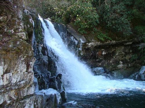
The path leading from the Cades Cove valley floor, to the waterfall, weaves around the ridges that predominate in this area, all the while roughly following Abrams Creek. The route traverses through pine-oak forest along the ridge tops, while passing through rhododendron and hemlock forests closer to the creek.
Directions
The hike to Abrams Falls begins from the Abrams Falls Trailhead, located at the far western end of Cades Cove. To reach the trailhead drive 4.8 miles along the one-way Cades Cove Loop Road. Just after crossing Abrams Creek turn right onto a gravel road. After driving another four-tenths of a mile through a grassy field you'll reach a large parking area where you'll find signs and a wooden footbridge that mark the trailhead.
About this event
The path leading from the Cades Cove valley floor, to the waterfall, weaves around the ridges that predominate in this area, all the while roughly following Abrams Creek. The route traverses through pine-oak forest along the ridge tops, while passing through rhododendron and hemlock forests closer to the creek.
Directions to the trailhead
Get directionsThe hike to Abrams Falls begins from the Abrams Falls Trailhead, located at the far western end of Cades Cove. To reach the trailhead drive 4.8 miles along the one-way Cades Cove Loop Road. Just after crossing Abrams Creek turn right onto a gravel road. After driving another four-tenths of a mile through a grassy field you'll reach a large parking area where you'll find signs and a wooden footbridge that mark the trailhead.
Who's going (2)
Questions about this event?
Questions for the host, gypsycamp, about route details, carpooling, or what to bring? Ask in the event discussion below.
Event discussion
No comments yet.
Log in to join the conversation.