
Mt. Garfield Hike
A good day for a crisp winter hike
Details
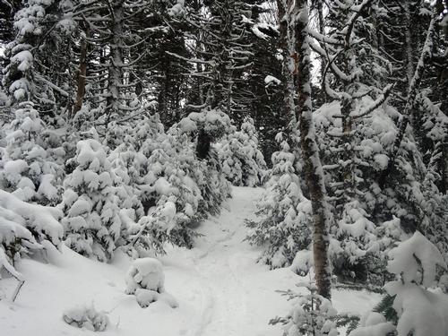
February – the heart of winter - a landscape of solid snow, temps in the 20’s and bright blue skies – brilliant times to be outdoors. Join Jim and I for a hike up to Mt. Garfield.
The Garfield Trail runs from the Gale River Loop Road. Because the loop road is closed in the winter, we’ll hike from the gated area off of Route 3 to the trail head. The trail mostly follows an old road used for access to a former fire lookout tower that once was at the summit of Garfield. The grades are mostly moderate all the way up except for a steep pitch just below the summit. On a clear day Mt. Garfield offers views of North & South Twin, the Franconia Ridge among other summits in the Pemigewasset Wilderness.
The Plan:
On Saturday we’ll meet at the gated area right off of route 3 for 8:15am. We’ll walk the 1.2 miles from the road to the trail head. The section of road is relatively flat and easy. From the trail head it is 4.8 miles of moderate grades to the summit. Along the way we’ll take water and snack breaks – make time for lunch – and of course – take in the views. Round trip is 12 miles. We’ll hike at a healthy pace. While the grades are moderate, it’s a full day of hiking. Be prepared for the distance which will include micro spikes and possibly snow shoes. Total elevation gain is 3,100’. The need for snow shoes will depend on snowfall preceding this hike – but I would anticipate needing them.
What to bring:
Food: Bring snacks and a lunch for the hike. A little extra is always good.
Water: Bring two or three liters (depending on how much you drink). Bottles should be in insulated – no hydration devices.
Clothing: No Cotton! Temps will vary from start to summit and summits are often windy. Bring layers, gloves, hat, face mask, hand warmers, micro-spikes, and other gear you may want for the hike. Your pack should be big enough to carry excess gear as you warm up. Inclement weather will cancel the trip but we do need to be prepared for unexpected changes in weather conditions.
Directions
Directions: From Route 93 North or South take exit 35 for route 3 towards Twin Mountain. Gale River Loop Road is .3 miles west of Trudeau Road (Five Corners) and 4.1 miles east of its junction with 141. Since we’ll be hiking to the trail head, parking should be quite near the turn. I’ll be driving a gray Honda CRV with Massachusetts license plates.
About this event
February – the heart of winter - a landscape of solid snow, temps in the 20’s and bright blue skies – brilliant times to be outdoors. Join Jim and I for a hike up to Mt. Garfield.
The Garfield Trail runs from the Gale River Loop Road. Because the loop road is closed in the winter, we’ll hike from the gated area off of Route 3 to the trail head. The trail mostly follows an old road used for access to a former fire lookout tower that once was at the summit of Garfield. The grades are mostly moderate all the way up except for a steep pitch just below the summit. On a clear day Mt. Garfield offers views of North & South Twin, the Franconia Ridge among other summits in the Pemigewasset Wilderness.
The Plan:
On Saturday we’ll meet at the gated area right off of route 3 for 8:15am. We’ll walk the 1.2 miles from the road to the trail head. The section of road is relatively flat and easy. From the trail head it is 4.8 miles of moderate grades to the summit. Along the way we’ll take water and snack breaks – make time for lunch – and of course – take in the views. Round trip is 12 miles. We’ll hike at a healthy pace. While the grades are moderate, it’s a full day of hiking. Be prepared for the distance which will include micro spikes and possibly snow shoes. Total elevation gain is 3,100’. The need for snow shoes will depend on snowfall preceding this hike – but I would anticipate needing them.
What to bring:
Food: Bring snacks and a lunch for the hike. A little extra is always good.
Water: Bring two or three liters (depending on how much you drink). Bottles should be in insulated – no hydration devices.
Clothing: No Cotton! Temps will vary from start to summit and summits are often windy. Bring layers, gloves, hat, face mask, hand warmers, micro-spikes, and other gear you may want for the hike. Your pack should be big enough to carry excess gear as you warm up. Inclement weather will cancel the trip but we do need to be prepared for unexpected changes in weather conditions.
Directions to the trailhead
Get directionsDirections: From Route 93 North or South take exit 35 for route 3 towards Twin Mountain. Gale River Loop Road is .3 miles west of Trudeau Road (Five Corners) and 4.1 miles east of its junction with 141. Since we’ll be hiking to the trail head, parking should be quite near the turn. I’ll be driving a gray Honda CRV with Massachusetts license plates.
Who's going (1)
Questions about this event?
Log in to see who's hosting and to ask them questions in the event discussion.
Log in
Event discussion
No comments yet.
Log in to join the conversation.