
Mt. Passaconway Hike
Brook, Lookout spots, Peakbag a 4,000 footer, lodging, meals, veterans's weekend
Mt. Passaconway Hike
Brook, Lookout spots, Peakbag a 4,000 footer, lodging, meals, veterans's weekend
Details
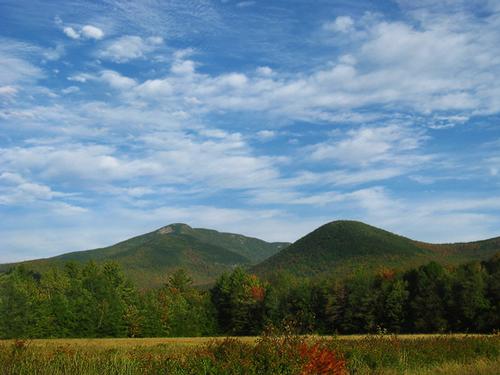
Mount Passaconway is a 4,043 foot mountain in the White Mountains. Many hikers miss the good views around the summit area, though there are none on the actual summit.
We will hike the Dicey's Mill Trail to the summit of Mount Passaconaway (4043'). This trail starts from the Ferncroft parking area. 4.5 miles, 2,800 foot ascent. 9 miles round trip. With shortened daylight it will be a full day; plan accordingly. While the summit has no views, there are several view points rather close to it that allow views in nearly all directions. Mt. Passaconaway is the 42nd highest peak in New Hampshire.
What to wear/bring: Wear warm clothing suitable for the hike in layers...no cotton or blue jeans. Wear a warm hat and gloves and bring handwarmers as a precaution. Bring along plenty of water (at least 2 liters), lunch, snacks and anything else you may require for a day hike. Contact us if you have any questions.
Afterwards: Everyone is welcome to join us back at our house in Waterville Valley to relax by our fireplace [BYOB and bring snacks] followed by one of Jon's delicious dinners. We ask $10 per person to help pay for our food costs. Showers are available so bring a change of clothing to make your visit with us more comfortable.
Lodging Option: Bunk beds are available at our house near Waterville Valley, NH. It's $35 for Saturday that includes dinner. Coffee/bagels each morning and linen/blankets/towels are provided. We have limited space in the fridge to store your beverages/food so it's best to bring a small cooler. Space is limited so email me ASAP to reserve a bunk!
Directions
The parking lot for this hike is located on Ferncroft Road in Wonalancet, NH.
From the South:
Take exit 24 off I-93 where you will end up on US-3/NH-25 towards Ashland/Holderness. Turn right onto Route 25 / E/US-3 / S/Daniel Webster Highway and follow for 4.4 miles. Turn left onto route 113 / Squam Lake Road and follow for 11.7 miles. Turn left onto route 113 / E/Maple Street and follow for 3.7 miles. Continue to follow route 113A W for 6.7 miles. Instead of turning onto the same route (113A) at a sharp 90 degree angle, you will stay straight onto Ferncroft Road. The parking lot is down the road on the right.
From the North (Berlin, NH area):
Follow route 16 South until it meets up with route 113 (Deer Hill / Silver Lake Road), where you will take a right onto route 113 West (Chocrua Road). Drive 2.9 miles and turn right on route 113A East and continue for 5.6 miles. Ferncroft Road will be on your right side. Drive down Ferncroft Road until you see a turn on the right side for a parking lot.
We'll be driving a blue Toyota Tacoma truck.
About this event
Mount Passaconway is a 4,043 foot mountain in the White Mountains. Many hikers miss the good views around the summit area, though there are none on the actual summit.
We will hike the Dicey's Mill Trail to the summit of Mount Passaconaway (4043'). This trail starts from the Ferncroft parking area. 4.5 miles, 2,800 foot ascent. 9 miles round trip. With shortened daylight it will be a full day; plan accordingly. While the summit has no views, there are several view points rather close to it that allow views in nearly all directions. Mt. Passaconaway is the 42nd highest peak in New Hampshire.
What to wear/bring: Wear warm clothing suitable for the hike in layers...no cotton or blue jeans. Wear a warm hat and gloves and bring handwarmers as a precaution. Bring along plenty of water (at least 2 liters), lunch, snacks and anything else you may require for a day hike. Contact us if you have any questions.
Afterwards: Everyone is welcome to join us back at our house in Waterville Valley to relax by our fireplace [BYOB and bring snacks] followed by one of Jon's delicious dinners. We ask $10 per person to help pay for our food costs. Showers are available so bring a change of clothing to make your visit with us more comfortable.
Lodging Option: Bunk beds are available at our house near Waterville Valley, NH. It's $35 for Saturday that includes dinner. Coffee/bagels each morning and linen/blankets/towels are provided. We have limited space in the fridge to store your beverages/food so it's best to bring a small cooler. Space is limited so email me ASAP to reserve a bunk!
Directions to the trailhead
Get directionsThe parking lot for this hike is located on Ferncroft Road in Wonalancet, NH.
From the South:
Take exit 24 off I-93 where you will end up on US-3/NH-25 towards Ashland/Holderness. Turn right onto Route 25 / E/US-3 / S/Daniel Webster Highway and follow for 4.4 miles. Turn left onto route 113 / Squam Lake Road and follow for 11.7 miles. Turn left onto route 113 / E/Maple Street and follow for 3.7 miles. Continue to follow route 113A W for 6.7 miles. Instead of turning onto the same route (113A) at a sharp 90 degree angle, you will stay straight onto Ferncroft Road. The parking lot is down the road on the right.
From the North (Berlin, NH area):
Follow route 16 South until it meets up with route 113 (Deer Hill / Silver Lake Road), where you will take a right onto route 113 West (Chocrua Road). Drive 2.9 miles and turn right on route 113A East and continue for 5.6 miles. Ferncroft Road will be on your right side. Drive down Ferncroft Road until you see a turn on the right side for a parking lot.
We'll be driving a blue Toyota Tacoma truck.
Who's going (3)


Questions about this event?
Reach out to the host, Gandalf, for route details, carpooling, or what to bring.
Email the hostYou can also ask in the event discussion below.
Event discussion
No comments yet.
Log in to join the conversation.