
Tellico Gap to Wesser - NC AT
AT Hike in NC - 7.9 miles Tellico Gap to Wesser where it crosses the Nantahala River
Tellico Gap to Wesser - NC AT
AT Hike in NC - 7.9 miles Tellico Gap to Wesser where it crosses the Nantahala River
Details
This will be a south to north hike on the Appalachian Trail in North Carolina. The hike will begin at Tellico Gap and end at Wesser, where the AT crosses the Nantahala River. This section of the AT in the Nantahala National Forest. The hike will be a strenuous 7.9 mile hike which will require us to shuttle cars between the trail heads.
This hike will begin at 3850 Ft. and climb to 4627 Ft., at Wesser Bald, before beginning a descent of about 3000 Ft. At about 3.8 miles the hike comes to an exposed knob called Jumpup. After resting here, we will begin a steep descent, dropping 1000 Ft. in about one mile. The hike will continue its descent to about 1723 Ft. at its end, at the Natahala Outdoor Center at the Nantahala River.
It is estimated that this hike will take about 6 to 7 hours.
Directions
The meeting place for this hike will be the Mc Donalds restaurant in Robbinsville, North Carolina. We plan to meet there about 8:00 AM. The address for the Mc Donalds is 374 Rodney Orr Bypass, Robbinsville, NC 28771.
We will be leaving the Mc Donalds for the trail head at 9:00 AM sharp. Please arrive early enough to meet and get directions to the trailheads.
About this event
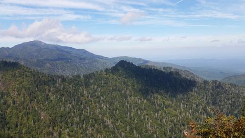
This will be a south to north hike on the Appalachian Trail in North Carolina. The hike will begin at Tellico Gap and end at Wesser, where the AT crosses the Nantahala River. This section of the AT in the Nantahala National Forest. The hike will be a strenuous 7.9 mile hike which will require us to shuttle cars between the trail heads.
This hike will begin at 3850 Ft. and climb to 4627 Ft., at Wesser Bald, before beginning a descent of about 3000 Ft. At about 3.8 miles the hike comes to an exposed knob called Jumpup. After resting here, we will begin a steep descent, dropping 1000 Ft. in about one mile. The hike will continue its descent to about 1723 Ft. at its end, at the Natahala Outdoor Center at the Nantahala River.
It is estimated that this hike will take about 6 to 7 hours.
Directions to the trailhead
Get directionsThe meeting place for this hike will be the Mc Donalds restaurant in Robbinsville, North Carolina. We plan to meet there about 8:00 AM. The address for the Mc Donalds is 374 Rodney Orr Bypass, Robbinsville, NC 28771.
We will be leaving the Mc Donalds for the trail head at 9:00 AM sharp. Please arrive early enough to meet and get directions to the trailheads.
Who's going (2)
 GUEST MEMBER
  GUEST MEMBER
 Questions about this event?
Reach out to the host, dnaturist, for route details, carpooling, or what to bring.
Email the hostYou can also ask in the event discussion below.
Event discussion
Log in to join the conversation.