
Afternoon Hike at Pocahontas State Park
Celebrate The Start of Daylights Savings
Afternoon Hike at Pocahontas State Park
Celebrate The Start of Daylights Savings
Details
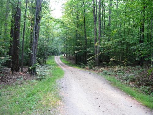
What: Hike the Beaver Lake Trail, Pocahontas State Park, Virginia’s largest state park. This is a very nice, 2.47 mile trail with enough elevation change to challenge, but not overwhelm this first of many hikes I have planned for Pocahontas and the surrounding Richmond area this year. It should take us 45-55 minutes. Bring some water and a snack if you choose as we’ll stop at a nice overlook and bench.
Additonal information:
http://www.dcr.virginia.gov/state_parks/poc.shtml
http://www.dcr.virginia.gov/state-parks/document/data/trail-guide-pocahontas.pdf
Directions
Where: Use mapquest or Maps.Google and search on Its address is 10301 State Park Road, Chesterfield, VA 23832-6355; Latitude, 37.373973. Longitude, -77.571782 or "State Park Road and Beach Road, Chesterfield, VA" to get to the turn off and to get to the main gate.
How to get there: We'll first meet near Ledo Pizza, 7052 Commons Plaza, Chesterfield, VA, just off Beach Road. I'll have a white 4-dr Honda Accord. Then we'll drive down the 3.5 miles to the entrance of the park. I have a park pass that we can use to get in for no charge. Or you can follow me down and pay to get in. The state charges $5 per car weekends.
The trail head is near the the Civilian Conservation Corps (CCC) Museum. We'll start the hike at the parking lot near.
About this event
What: Hike the Beaver Lake Trail, Pocahontas State Park, Virginia’s largest state park. This is a very nice, 2.47 mile trail with enough elevation change to challenge, but not overwhelm this first of many hikes I have planned for Pocahontas and the surrounding Richmond area this year. It should take us 45-55 minutes. Bring some water and a snack if you choose as we’ll stop at a nice overlook and bench.
Additonal information:
http://www.dcr.virginia.gov/state_parks/poc.shtml
http://www.dcr.virginia.gov/state-parks/document/data/trail-guide-pocahontas.pdf
Directions to the trailhead
Get directionsWhere: Use mapquest or Maps.Google and search on Its address is 10301 State Park Road, Chesterfield, VA 23832-6355; Latitude, 37.373973. Longitude, -77.571782 or "State Park Road and Beach Road, Chesterfield, VA" to get to the turn off and to get to the main gate.
How to get there: We'll first meet near Ledo Pizza, 7052 Commons Plaza, Chesterfield, VA, just off Beach Road. I'll have a white 4-dr Honda Accord. Then we'll drive down the 3.5 miles to the entrance of the park. I have a park pass that we can use to get in for no charge. Or you can follow me down and pay to get in. The state charges $5 per car weekends.
The trail head is near the the Civilian Conservation Corps (CCC) Museum. We'll start the hike at the parking lot near.
Who's going (2)
 GUEST MEMBER
  GUEST MEMBER
 Questions about this event?
Questions for the host, TrailGuyEric, about route details, carpooling, or what to bring? Ask in the event discussion below.
Event discussion
No comments yet.
Log in to join the conversation.