
Welch-Dickey hike
Welch Dickey Hike
Details
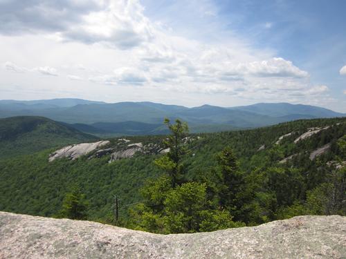
Join Don and myself as we hike Welch-Dickey. The hike is 4 1/2 miles long with 1850 feet of elevation gain. This trip is one of our favorite hikes in the White Mountains. The hike showcases everything the White Mountains have to offer: steep slopes, open ledges, a rocky scramble, woodland trails, but all in moderation. The spectacular views make this hike very rewarding for such a modest effort. We’ll be having lunch along the hike. Dress appropriately for early May weather in the White Mountains; bring a windbreaker/raingear (just in case). Also bring along lunch, snacks and water. Please no dogs on this hike.
Directions
Take Exit 28 (Campton/Waterville Valley) and head east on Rt. 49, the Mad River Road. In about a mile you will reach a traffic light at the intersection of Rt. 49 and Rt. 175. The Campton dam will be on your right, and the ledges of Welch-Dickey will be visible straight ahead from here. Go through the traffic light, staying on Rt. 49, and in about 4.5 miles turn left onto Upper Mad River Road (crossing the Mad River on a bridge as you do so). Stay on this road as it winds, and in 0.7 mile turn right onto Orris Road. There will be a sign here for the Welch-Dickey trail, so you can't miss it. Stay on Orris for about 0.6 mile and enter the parking lot on the right.
We'll be driving a green Mini-Cooper.
About this event
Join Don and myself as we hike Welch-Dickey. The hike is 4 1/2 miles long with 1850 feet of elevation gain. This trip is one of our favorite hikes in the White Mountains. The hike showcases everything the White Mountains have to offer: steep slopes, open ledges, a rocky scramble, woodland trails, but all in moderation. The spectacular views make this hike very rewarding for such a modest effort. We’ll be having lunch along the hike. Dress appropriately for early May weather in the White Mountains; bring a windbreaker/raingear (just in case). Also bring along lunch, snacks and water. Please no dogs on this hike.
Directions to the trailhead
Get directionsTake Exit 28 (Campton/Waterville Valley) and head east on Rt. 49, the Mad River Road. In about a mile you will reach a traffic light at the intersection of Rt. 49 and Rt. 175. The Campton dam will be on your right, and the ledges of Welch-Dickey will be visible straight ahead from here. Go through the traffic light, staying on Rt. 49, and in about 4.5 miles turn left onto Upper Mad River Road (crossing the Mad River on a bridge as you do so). Stay on this road as it winds, and in 0.7 mile turn right onto Orris Road. There will be a sign here for the Welch-Dickey trail, so you can't miss it. Stay on Orris for about 0.6 mile and enter the parking lot on the right.
We'll be driving a green Mini-Cooper.
Who's going (3)

Questions about this event?
Reach out to the host, Cartman, for route details, carpooling, or what to bring.
Email the hostYou can also ask in the event discussion below.
Event discussion
The good news is that I still plan to join the Lonesome Lake hike on Sunday.
My best to you all,
John
Log in to join the conversation.