
Temescal Canyon to Skull Rock Hike
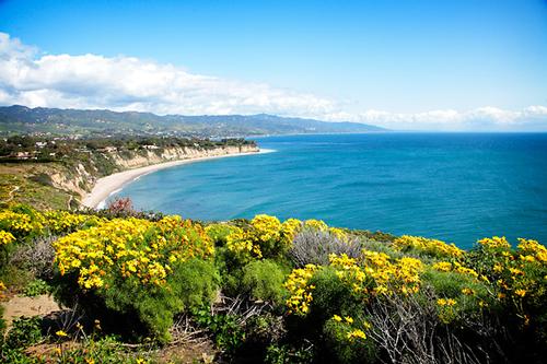
Spectacular Views of Surrounding Canyons and Amazing Red Rock Formations
Temescal Canyon to Skull Rock Hike
Spectacular Views of Surrounding Canyons and Amazing Red Rock Formations
Details
Date: January 30, 2015
Time: 10:00 am
Near: Pacific Palisades, CA 90272
Distance: 6.25 miles round trip
Difficulty: Moderate
Elevation: 1000 feet
Hike Time: 4 1/2 hours
Hike Type: Loop
Summary: Temescal Canyon is a great Santa Monica Mountains sampler. You get an oak and sycamore shaded canyon, a seasonal waterfall and terrific views from the ridge crest. The loop starts out on Temescal Ridge Trail, climbing almost 1,000 feet in the first mile. At the intersection with Temescal Canyon Trail, we will take the half-mile side trip to Skull Rock, aptly named for its shape. We will continue on the ridge trail for another ½ mile for more terrific views. We will return to Skull Rock for lunch while enjoying the views.
Directions
Directions: From Santa Monica, drive north on Pacific Coast Highway 1 to Temescal Canyon Road and turn right. Drive approximately 1.1 miles until you reach Sunset Blvd. There is plenty of parking on the street. Enter Temescal Gateway Park and stay on the left. We will meet at the tables near the restrooms covered in stone.
What to Bring: Good hiking boots/shoes. A hiking/trekking pole may be useful for the occasional step ascent/descent on the trail, but not necessary. Pack a lunch, snacks and bring plenty of water. Bring a hat/cap and sunscreen.
RAIN CANCELS. Check the weather and bring appropriate layers of clothing and extra pair of shoes if your hiking boots get muddy.
Menard is leading this hike for both the Gay Outdoors and the Great Outdoors members. Note: women may be participating.
About this event
Date: January 30, 2015
Time: 10:00 am
Near: Pacific Palisades, CA 90272
Distance: 6.25 miles round trip
Difficulty: Moderate
Elevation: 1000 feet
Hike Time: 4 1/2 hours
Hike Type: Loop
Summary: Temescal Canyon is a great Santa Monica Mountains sampler. You get an oak and sycamore shaded canyon, a seasonal waterfall and terrific views from the ridge crest. The loop starts out on Temescal Ridge Trail, climbing almost 1,000 feet in the first mile. At the intersection with Temescal Canyon Trail, we will take the half-mile side trip to Skull Rock, aptly named for its shape. We will continue on the ridge trail for another ½ mile for more terrific views. We will return to Skull Rock for lunch while enjoying the views.
Directions to the trailhead
Get directionsDirections: From Santa Monica, drive north on Pacific Coast Highway 1 to Temescal Canyon Road and turn right. Drive approximately 1.1 miles until you reach Sunset Blvd. There is plenty of parking on the street. Enter Temescal Gateway Park and stay on the left. We will meet at the tables near the restrooms covered in stone.
What to Bring: Good hiking boots/shoes. A hiking/trekking pole may be useful for the occasional step ascent/descent on the trail, but not necessary. Pack a lunch, snacks and bring plenty of water. Bring a hat/cap and sunscreen.
RAIN CANCELS. Check the weather and bring appropriate layers of clothing and extra pair of shoes if your hiking boots get muddy.
Menard is leading this hike for both the Gay Outdoors and the Great Outdoors members. Note: women may be participating.
Who's going (2)
 GUEST MEMBER
 Questions about this event?
Questions for the host, Menard, about route details, carpooling, or what to bring? Ask in the event discussion below.
Event discussion
No comments yet.
Log in to join the conversation.