
Mt Hale-East Hale Hike
A Modest Hike to Mt. Hale with some Bushwhacking to the More Remarkable East Peak Ledges.
Mt Hale-East Hale Hike
A Modest Hike to Mt. Hale with some Bushwhacking to the More Remarkable East Peak Ledges.
Details
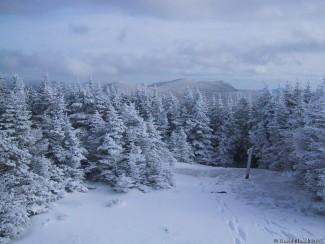
Mt. Hale is one of least remarkable 4000-footers in the White Mountains (besides Zealand). Its summit stands at 4054 feet and is a large open area completely encircled by trees. The summit is marked by a large cairn, where a fire tower once stood. A view can sometimes be had from atop of the large summit cairn. East Hale is made up of open ledge(s) with wonderful views out over to the Willey Range, Presidential Range and Zealand Notch. Half of this hike is via Zealand Road, which is closed in the winter. The Hale Brook Trail will be used to the summit of Hale and then we will bushwhack over to East Hale...descending back to the Hale Brook Trail. NOTE: Much of the bushwhack portion of this hike is through mostly open woods but it may require “trail-breaking”.
Total Distance and Elevation Gain: ~9.2 miles with approximately 2580 feet in elevation gain.
Total Time: 7-8 hours depending on breaks and group's speed.
Harsh weather may postpone to another date or cancel, as appropriate.
What to Wear/Bring: Snowshoes may likely still be necessary and should be adequate for the entire hike (microspikes should be packed as well). Wear warm layered clothing suitable for the exposed ledge(s) and summit(s)...no cotton or blue jeans. You should also have insulated boots and gloves suitable for the season. Additionally, consider bringing goggles, face protection, hand warmers and a headlamp/flashlight. Bring along plenty of water (at least 2 liters), lunch, snacks and anything else you may require for a day hike.
Carpooling: Contact other participants or the trip leader to arrange for a rideshare to the trailhead.
Afterwards: If there is sufficient interest, we will have drinks and/or dinner in the area. Most likely Fabyan's in Bretton Woods.
Directions
From the junction of Routes 302 and 3 in Twin Mountain, drive 2.4 miles east along Route 302. The WINTER parking area is just past the Zealand Campground. It is a large parking area on the left. From the junction of Routes 302 and 16 in Glen, drive 26.6 miles west along Route 302. The parking area will be on your right. Look for a gray Hyundai Elantra.
For GPS Users: 44.265135, -71.494726
About this event
Mt. Hale is one of least remarkable 4000-footers in the White Mountains (besides Zealand). Its summit stands at 4054 feet and is a large open area completely encircled by trees. The summit is marked by a large cairn, where a fire tower once stood. A view can sometimes be had from atop of the large summit cairn. East Hale is made up of open ledge(s) with wonderful views out over to the Willey Range, Presidential Range and Zealand Notch. Half of this hike is via Zealand Road, which is closed in the winter. The Hale Brook Trail will be used to the summit of Hale and then we will bushwhack over to East Hale...descending back to the Hale Brook Trail. NOTE: Much of the bushwhack portion of this hike is through mostly open woods but it may require “trail-breaking”.
Total Distance and Elevation Gain: ~9.2 miles with approximately 2580 feet in elevation gain.
Total Time: 7-8 hours depending on breaks and group's speed.
Harsh weather may postpone to another date or cancel, as appropriate.
What to Wear/Bring: Snowshoes may likely still be necessary and should be adequate for the entire hike (microspikes should be packed as well). Wear warm layered clothing suitable for the exposed ledge(s) and summit(s)...no cotton or blue jeans. You should also have insulated boots and gloves suitable for the season. Additionally, consider bringing goggles, face protection, hand warmers and a headlamp/flashlight. Bring along plenty of water (at least 2 liters), lunch, snacks and anything else you may require for a day hike.
Carpooling: Contact other participants or the trip leader to arrange for a rideshare to the trailhead.
Afterwards: If there is sufficient interest, we will have drinks and/or dinner in the area. Most likely Fabyan's in Bretton Woods.
Directions to the trailhead
Get directionsFrom the junction of Routes 302 and 3 in Twin Mountain, drive 2.4 miles east along Route 302. The WINTER parking area is just past the Zealand Campground. It is a large parking area on the left. From the junction of Routes 302 and 16 in Glen, drive 26.6 miles west along Route 302. The parking area will be on your right. Look for a gray Hyundai Elantra.
For GPS Users: 44.265135, -71.494726
Who's going (2)
 GUEST MEMBER
 Questions about this event?
Reach out to the host, shep5, for route details, carpooling, or what to bring.
Email the hostYou can also ask in the event discussion below.
Event discussion
Log in to join the conversation.