
Cornell & Wittenberg Hike
A Rugged but Beautiful Hike up to the Summits of Cornell and Wittenberg Mountains.
Cornell & Wittenberg Hike
A Rugged but Beautiful Hike up to the Summits of Cornell and Wittenberg Mountains.
Details
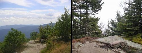
Join me for this out-and-back hike to Cornell and Wittenberg Mountains. We'll start out at the trailhead near the entrance to Woodland Valley Campground. The trail enters the woods to the south, immediately crossing the Woodland Creek. The trail varies in grade for the first few miles, but tends to be on the modest side. Afterwards it becomes more agressive on the way to Wittenberg Mountain (3780'). The summit is spectacular and provides views into the surrounding wilderness as well as over the entire length of the Ashokan Reservoir to the east. The trail continues over to Cornell Mountain (3860), where a short steep scramble is encountered just prior to reaching the mostly treed summit (Cornell Crack). There are limited views from the summit as well as from just beyond on the western side. We'll return via the same route. There is an optional side trip out to Terrace Mountain adding about 1.8 miles. This will be up to the group.
Total Distance and Elevation Gain: 9.6 miles with approximately 2640 feet of accumulative elevation gain.
Total Time: 8 hours or more depending on breaks and lunch.
Rain or harsh weather will postpone to another date, as appropriate.
Camping Option: Contact me, if you're interested in camping Friday and/or Saturday night. I would be happy to set something up or provide details to share my site.
What to Bring: Typical summer hiking gear should be appropriate: convertible hiking pants or shorts, good sturdy hiking boots with thick socks, extra layer(s) (as needed) and a windbreaker/raingear (just in case). Also bring along lunch, snacks and plenty of water (at least 2-L). Optionally, pack bug repellent and sunscreen and anything else that you may require for a day hike.
Afterwards: We should be completed with the hike by 5:00PM. If there is sufficient interest, we can grab dinner/drinks in Phoenicia (Brio's).
Directions
Take Exit 19 off the Thruway (I-87) and take Route 28W for 23.2 miles. After passing Phoenicia, turn left onto Woodland Valley Road and continue to the campground at the end (about 5.1 miles). Trailhead parking is near the camp headquarters.
NOTE: There is a parking fee, which must be paid to the campground (unless you're camping at a DEC site).
Look for a grey Hyundai Elantra.
For GPS Users: 1319 Woodland Valley Rd, Phoenicia, NY (42.035676,-74.365341) (trailhead).
About this event
Join me for this out-and-back hike to Cornell and Wittenberg Mountains. We'll start out at the trailhead near the entrance to Woodland Valley Campground. The trail enters the woods to the south, immediately crossing the Woodland Creek. The trail varies in grade for the first few miles, but tends to be on the modest side. Afterwards it becomes more agressive on the way to Wittenberg Mountain (3780'). The summit is spectacular and provides views into the surrounding wilderness as well as over the entire length of the Ashokan Reservoir to the east. The trail continues over to Cornell Mountain (3860), where a short steep scramble is encountered just prior to reaching the mostly treed summit (Cornell Crack). There are limited views from the summit as well as from just beyond on the western side. We'll return via the same route. There is an optional side trip out to Terrace Mountain adding about 1.8 miles. This will be up to the group.
Total Distance and Elevation Gain: 9.6 miles with approximately 2640 feet of accumulative elevation gain.
Total Time: 8 hours or more depending on breaks and lunch.
Rain or harsh weather will postpone to another date, as appropriate.
Camping Option: Contact me, if you're interested in camping Friday and/or Saturday night. I would be happy to set something up or provide details to share my site.
What to Bring: Typical summer hiking gear should be appropriate: convertible hiking pants or shorts, good sturdy hiking boots with thick socks, extra layer(s) (as needed) and a windbreaker/raingear (just in case). Also bring along lunch, snacks and plenty of water (at least 2-L). Optionally, pack bug repellent and sunscreen and anything else that you may require for a day hike.
Afterwards: We should be completed with the hike by 5:00PM. If there is sufficient interest, we can grab dinner/drinks in Phoenicia (Brio's).
Directions to the trailhead
Get directionsTake Exit 19 off the Thruway (I-87) and take Route 28W for 23.2 miles. After passing Phoenicia, turn left onto Woodland Valley Road and continue to the campground at the end (about 5.1 miles). Trailhead parking is near the camp headquarters.
NOTE: There is a parking fee, which must be paid to the campground (unless you're camping at a DEC site).
Look for a grey Hyundai Elantra.
For GPS Users: 1319 Woodland Valley Rd, Phoenicia, NY (42.035676,-74.365341) (trailhead).
Who's going (1)
 GUEST MEMBER
Questions about this event?
Reach out to the host, shep5, for route details, carpooling, or what to bring.
Email the hostYou can also ask in the event discussion below.
Event discussion
No comments yet.
Log in to join the conversation.