HE Travel Gay Travel Tours
All events Share Moderate to Strenuous

Mt. Baldy via Ski Hut Trail Hike

Mt. Baldy via Ski Hut Trail Hike

Mt. Baldy via Ski Hut Trail Hike

Mt. Baldy via Ski Hut Trail Hike

Details

Departure Time: Please arrive by 9:00 AM to allow 15 minutes for parking and introductions. We will start hiking at 9:15 AM.
Parking: A National Forest Adventure Pass is required for parking. Each vehicle must display this pass. David owns 2 Adventure passes-1 for his car and the other for the 1st person who request it. Daily or Annual passes can be purchased at REI or other sporting goods stores.
Ability Level: Advanced
This hike will be strenuous due to distance, pace, total elevation gain/loss and around mid 70's at the trailhead. It is likely to be in the low 50's at the summit. 
About the Hike:
Distance: 8.4 miles (out and back)
Elevation: 3,900 ft,gain/loss                                                         
Pace:  Moderate                           
Level:  Advanced
Time: 6-7 hours
Description:
Park along Mount Baldy Road just past Manker Flats Campground at the bottom of Falls Road (anywhere near the portable toilets-where cars are parked).
We will start hiking up the paved road toward San Antonio Falls (0.6 miles) A third of a mile past the falls, turn left up a narrow, marked signpost, trail and hike up to the Sierra Club Ski Hut (2.6 miles)
Cross Baldy Bowl and hike north up a ridge to the summit (4.5 miles)
Enjoy lunch and the views from the highest summit in the San Gabriel Mountains 

Directions

Directions to the Trailhead:

57 North, 210 East, Exit 52 - Baseline. Turn Left onto E. Baseline. 1st Right onto Padua. In 1.7 miles, turn Right onto Mt. Baldy Road.  After 7 miles, pass Village, continue to Manker Flats

Trailhead address: Mount Baldy Road & Falls Road, Angeles National Forest, Mount Baldy, CA 91759.  Trailhead coordinates: 34.266172, -117.62684

Carpooling:  Contact David or Menard.

Rain or extreme weather may cancel this hike. 
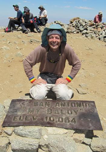
Sunday, August 18, 2013
Mt. Baldy, CA · Directions
Meet at 9:00 AM
Hosted by Menard
5/25 signed up
Mt. Baldy via Ski Hut Trail Hike

About this event

Departure Time: Please arrive by 9:00 AM to allow 15 minutes for parking and introductions. We will start hiking at 9:15 AM.
Parking: A National Forest Adventure Pass is required for parking. Each vehicle must display this pass. David owns 2 Adventure passes-1 for his car and the other for the 1st person who request it. Daily or Annual passes can be purchased at REI or other sporting goods stores.
Ability Level: Advanced
This hike will be strenuous due to distance, pace, total elevation gain/loss and around mid 70's at the trailhead. It is likely to be in the low 50's at the summit. 
About the Hike:
Distance: 8.4 miles (out and back)
Elevation: 3,900 ft,gain/loss                                                         
Pace:  Moderate                           
Level:  Advanced
Time: 6-7 hours
Description:
Park along Mount Baldy Road just past Manker Flats Campground at the bottom of Falls Road (anywhere near the portable toilets-where cars are parked).
We will start hiking up the paved road toward San Antonio Falls (0.6 miles) A third of a mile past the falls, turn left up a narrow, marked signpost, trail and hike up to the Sierra Club Ski Hut (2.6 miles)
Cross Baldy Bowl and hike north up a ridge to the summit (4.5 miles)
Enjoy lunch and the views from the highest summit in the San Gabriel Mountains 

Directions to the trailhead

Get directions
Opens turn-by-turn directions to Mt. Baldy, CA, 91759 in Google Maps (new tab).

Directions to the Trailhead:

57 North, 210 East, Exit 52 - Baseline. Turn Left onto E. Baseline. 1st Right onto Padua. In 1.7 miles, turn Right onto Mt. Baldy Road.  After 7 miles, pass Village, continue to Manker Flats

Trailhead address: Mount Baldy Road & Falls Road, Angeles National Forest, Mount Baldy, CA 91759.  Trailhead coordinates: 34.266172, -117.62684

Carpooling:  Contact David or Menard.

Rain or extreme weather may cancel this hike. 

Who's going (5)
bytebit GUEST MEMBER
bytebit
Palm Springs, CA
A member
Profile hidden
csmith71 GUEST MEMBER
csmith71
Ossipee, NH
ronnieshumate GUEST MEMBER
ronnieshumate
Ossipee, NH
halligan151 GUEST MEMBER
halligan151
Long Beach, CA

Questions about this event?

Questions for the host, Menard, about route details, carpooling, or what to bring? Ask in the event discussion below.

Event discussion

M
Member · Aug 10, 2013
d page. Arrive at 9:00 am so we can get started on the hike at 9:15
M
Member · Aug 10, 2013
d page. Arrive at 9:00 am so we can get started on the hike at 9:15
csmith71 · Aug 18, 2013
Thank you David and Menard for this great hike today. Ronnie and I had a great time. It was difficult but we felt really good about accomplishing the hike. -Chris
M
Member · Aug 21, 2013
It was a great hike on a great day. Thank you all for attending and thanks to David for leading.

Log in to join the conversation.

Stay Connected with GayOutdoors

Receive outdoorsy tips, community updates, volunteer opportunities, event announcements, and trip reports.

We respect your privacy — unsubscribe anytime.