
All events
Share
Moderate
GetFit#4: Jennings Peak
On the 4th hike of the GetFit series, we summit Jennings Peak
GetFit#4: Jennings Peak
On the 4th hike of the GetFit series, we summit Jennings Peak
Details
The 4th hike in the GetFit series is a loop hike involves ascending the Sandwich Mountain Trail and descending the Drakes Brook Trail.
Total Elevation Gain (Jennings Peak only): 2055'
Total Roundtrip Distance (Jennings Peak only): 6.5 miles
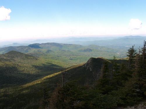
We will start the loop hike by heading up the Sandwich Mountain Trail. The trail begins at the Drakes Brook Trailhead. It descends at a gradual through a field with a power grid on the right before turning into the woods and descending towards Drakes Brook. Once across Drakes Brook the trail starts to ascend Noon Peak moderately. The trail becomes steeper and steeper, until it hits a section where it becomes a scramble or poor footing on tree roots. The route moderates and continues it climb to Noon Peak. As it become close to the summit of Noon Peak views start to open up Toward Sandwich Mountain and Jennings Peak. The trail then alternate between moderate and gradual grade and has one more small scramble until it reaches the summit of Noon Peak (1.7 miles).
From the top of Noon Peak, the stay most gradual to moderate until it runs into the Drakes Brook Trail at 2.7 mile and at 2.8 mile it runs into the Jennings Peak spur path. From there head up the steep Jennings Peak spur path to the summit.
When descending we will take the Drakes Brook Trail. The trail (0.1 mile on the Sandwich Mountain Trail will descend for the next 0.6 miles at a moderate to steeper grade. Once the trail approaches Drakes Brook it will then become very gradual with some small moderate pitch to the logging road/ ski trail. From there it will continue 0.4 mile to the trailhead.
Stuff To Bring:
•Non-cotton clothing [synthetics/wool]
•Layers
•Rain Gear
•Proper footwear [hiking shoes/boots]
•At least 2 liters of water
•Sunscreen/Sunglasses
•Lunch/snacks
Lodging Option: Mike was nice enough to let us use his house for the weekend in Waterville Valley. We have 8 bunks available with linen for Friday and/or Saturday night for $20. You can use the kitchen facilities and store beverages/food in the fridge. There is coffee available in the morning and a continental breakfast. Contact one of us to RSVP. SPACE IS LIMITED TO EIGHT GUYS.
Directions
From I-93 get off exit 28 onto Route 49 toward Waterville Valley. Stay on Route 49 eleven miles to the trailhead which is on the right, just after Sandwich Notch Road & before the town of Waterville Valley.
About this event
The 4th hike in the GetFit series is a loop hike involves ascending the Sandwich Mountain Trail and descending the Drakes Brook Trail.
Total Elevation Gain (Jennings Peak only): 2055'
Total Roundtrip Distance (Jennings Peak only): 6.5 miles
We will start the loop hike by heading up the Sandwich Mountain Trail. The trail begins at the Drakes Brook Trailhead. It descends at a gradual through a field with a power grid on the right before turning into the woods and descending towards Drakes Brook. Once across Drakes Brook the trail starts to ascend Noon Peak moderately. The trail becomes steeper and steeper, until it hits a section where it becomes a scramble or poor footing on tree roots. The route moderates and continues it climb to Noon Peak. As it become close to the summit of Noon Peak views start to open up Toward Sandwich Mountain and Jennings Peak. The trail then alternate between moderate and gradual grade and has one more small scramble until it reaches the summit of Noon Peak (1.7 miles).
From the top of Noon Peak, the stay most gradual to moderate until it runs into the Drakes Brook Trail at 2.7 mile and at 2.8 mile it runs into the Jennings Peak spur path. From there head up the steep Jennings Peak spur path to the summit.
When descending we will take the Drakes Brook Trail. The trail (0.1 mile on the Sandwich Mountain Trail will descend for the next 0.6 miles at a moderate to steeper grade. Once the trail approaches Drakes Brook it will then become very gradual with some small moderate pitch to the logging road/ ski trail. From there it will continue 0.4 mile to the trailhead.
Stuff To Bring:
•Non-cotton clothing [synthetics/wool]
•Layers
•Rain Gear
•Proper footwear [hiking shoes/boots]
•At least 2 liters of water
•Sunscreen/Sunglasses
•Lunch/snacks
Lodging Option: Mike was nice enough to let us use his house for the weekend in Waterville Valley. We have 8 bunks available with linen for Friday and/or Saturday night for $20. You can use the kitchen facilities and store beverages/food in the fridge. There is coffee available in the morning and a continental breakfast. Contact one of us to RSVP. SPACE IS LIMITED TO EIGHT GUYS.
Directions to the trailhead
Get directions Opens turn-by-turn directions to Waterville Valley, NH, 031215 in Google Maps (new tab).
From I-93 get off exit 28 onto Route 49 toward Waterville Valley. Stay on Route 49 eleven miles to the trailhead which is on the right, just after Sandwich Notch Road & before the town of Waterville Valley.
Who's going (3)
 GUEST MEMBER
DaveSchumaker
Manchester, NH
 SUSTAINING
HikerBiker
Manchester, NH
 SUSTAINING
JollyGreen
Boston, MA
Questions about this event?
Reach out to the host, DaveSchumaker, for route details, carpooling, or what to bring.
Email the hostYou can also ask in the event discussion below.
Event discussion
No comments yet.
Log in to join the conversation.