
West Kill Peak Hike
A Modest Out-and-back Catskill Park Hike to West Kill Peak.
West Kill Peak Hike
A Modest Out-and-back Catskill Park Hike to West Kill Peak.
Details
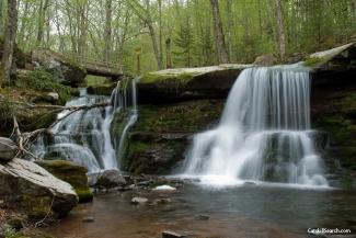
Join me for this modest hike to West Kill Peak at an elevation of 3880 feet. West Kill is the sixth highest peak in the Catskills. We will meet up at the end of Spruceton Road for the 6.4 mile hike out to the peak and back. Along the way we'll pass the very picturesque Diamond Notch Falls and a rock cave. While the summit itself is treed, there are two ledges near the summit, which provide arguably some of the best views in the Catskills....south to Lanesville and north to Spruceton from Buck Ridge.
Total Distance and Elevation Gain: 6.4 miles with approximately 1786 feet in accumulative elevation gain.
Total Time: 5-6 hours or more depending on breaks and group's speed.
Rain or harsh weather will postpone until another date, as appropriate.
Camping Option: Contact me, if you're interested in camping Friday and/or Saturday night. I would be happy to set something up or provide details to share my site.
What to Bring: Typical summer hiking gear should be appropriate: convertible hiking pants or shorts, good sturdy hiking boots with thick socks, extra layer(s) (as needed) and a windbreaker/raingear (just in case). Also bring along lunch, snacks and plenty of water (at least 2-L). Optionally, pack bug repellent and sunscreen and anything else that you may require for a day hike.
Afterwards: We should be completed with the hike by 3:00PM. If there is sufficient interest, we can grab a light snack/drinks in Hunter.
Directions
Take exit 20 off the Thruway (I-87) for NY-32 toward Saugerties and continue on Route 32 N for 6.5 miles. Turn onto Route 32A N and follow this for 1.9 miles. Turn onto Route 23A West and continue for 19.8 miles. In Lexington, turn left onto Route 42 S and follow for 4.1 miles. In Spruceton, turn left onto Spruceton Road (County Road 6) and follow to the trailhead at the end (approximately 6.8 miles).
From the Northway/Thruway (I-87) it should take approximately 64 minutes (39 miles).
For GPS Users: 42.183377,-74.270768 (trailhead).
Look for a grey Hyundai Elantra.
About this event
Join me for this modest hike to West Kill Peak at an elevation of 3880 feet. West Kill is the sixth highest peak in the Catskills. We will meet up at the end of Spruceton Road for the 6.4 mile hike out to the peak and back. Along the way we'll pass the very picturesque Diamond Notch Falls and a rock cave. While the summit itself is treed, there are two ledges near the summit, which provide arguably some of the best views in the Catskills....south to Lanesville and north to Spruceton from Buck Ridge.
Total Distance and Elevation Gain: 6.4 miles with approximately 1786 feet in accumulative elevation gain.
Total Time: 5-6 hours or more depending on breaks and group's speed.
Rain or harsh weather will postpone until another date, as appropriate.
Camping Option: Contact me, if you're interested in camping Friday and/or Saturday night. I would be happy to set something up or provide details to share my site.
What to Bring: Typical summer hiking gear should be appropriate: convertible hiking pants or shorts, good sturdy hiking boots with thick socks, extra layer(s) (as needed) and a windbreaker/raingear (just in case). Also bring along lunch, snacks and plenty of water (at least 2-L). Optionally, pack bug repellent and sunscreen and anything else that you may require for a day hike.
Afterwards: We should be completed with the hike by 3:00PM. If there is sufficient interest, we can grab a light snack/drinks in Hunter.
Directions to the trailhead
Get directionsTake exit 20 off the Thruway (I-87) for NY-32 toward Saugerties and continue on Route 32 N for 6.5 miles. Turn onto Route 32A N and follow this for 1.9 miles. Turn onto Route 23A West and continue for 19.8 miles. In Lexington, turn left onto Route 42 S and follow for 4.1 miles. In Spruceton, turn left onto Spruceton Road (County Road 6) and follow to the trailhead at the end (approximately 6.8 miles).
From the Northway/Thruway (I-87) it should take approximately 64 minutes (39 miles).
For GPS Users: 42.183377,-74.270768 (trailhead).
Look for a grey Hyundai Elantra.
Who's going (3)


Questions about this event?
Reach out to the host, shep5, for route details, carpooling, or what to bring.
Email the hostYou can also ask in the event discussion below.
Event discussion
Log in to join the conversation.