
Mt. Osceola Hike
Mt. Osceola Hike in Waterville Valley
Details
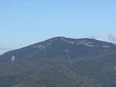
For a four thousand footer, this is a relatively moderate hike. The round trip will be 6.4 miles with a 2,000 foot ascent. The trail itself is moderately graded, with a steady upward slant. The summit offers great views of the Waterville Valley area. There is a chance of thunderstorms for this Sunday hike, so come prepared for inclement weather. If indeed the weather does not cooperate, safety is of primary importance, and we may skip the summit, since its open ledges may be dangerous if lighting strikes.
Directions
We will meet at the trailhead on Tripoli Rd. Directions are as follows: take exit 28 on I-93, and go east on Rt. 49 towards its end at Waterville Valley. As you enter the outskirts of the town, you will see Tripoli Rd. on the left. There are signs there directing you to the Waterville Valley ski slopes, so turn left there. However, when you get to the fork on the road, bear right onto Tripoli Rd. (the left fork takes you to the parking lot of the ski slopes). The trailhead parking lot is located just west of the height-of-land at the Thornton Gap. It is well marked, but is small, so it may be full when you get there. You can park on the side of Tripoli Rd. There is a fee for parking at the WMNF parking lot, but not if you park on the side of the road. We will meet by the trailhead kiosk.
About this event
For a four thousand footer, this is a relatively moderate hike. The round trip will be 6.4 miles with a 2,000 foot ascent. The trail itself is moderately graded, with a steady upward slant. The summit offers great views of the Waterville Valley area. There is a chance of thunderstorms for this Sunday hike, so come prepared for inclement weather. If indeed the weather does not cooperate, safety is of primary importance, and we may skip the summit, since its open ledges may be dangerous if lighting strikes.
Directions to the trailhead
Get directionsWe will meet at the trailhead on Tripoli Rd. Directions are as follows: take exit 28 on I-93, and go east on Rt. 49 towards its end at Waterville Valley. As you enter the outskirts of the town, you will see Tripoli Rd. on the left. There are signs there directing you to the Waterville Valley ski slopes, so turn left there. However, when you get to the fork on the road, bear right onto Tripoli Rd. (the left fork takes you to the parking lot of the ski slopes). The trailhead parking lot is located just west of the height-of-land at the Thornton Gap. It is well marked, but is small, so it may be full when you get there. You can park on the side of Tripoli Rd. There is a fee for parking at the WMNF parking lot, but not if you park on the side of the road. We will meet by the trailhead kiosk.
Who's going (2)
 SUSTAINING
 GUEST MEMBER
Questions about this event?
Reach out to the host, JPHiker, for route details, carpooling, or what to bring.
Email the hostYou can also ask in the event discussion below.
Event discussion
No comments yet.
Log in to join the conversation.