
CT Appalachian Trail to Bull's Bridge
Details
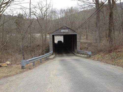
Join us for a moderate there-and-back-again 6.5 mile hike via the Appalachian Trail in western CT. We'll hike near the western border of CT and then along the ragin' Housatonic River. There will be beautiful views of the Housatonic River valley, and a great mid-river viewpoint on an island where we'll have our lunch stop within sight of Bull's Bridge covered bridge and the nearby falls. Expect rocky trails and one long sustained hill climb each way.
If there's interest afterward we can go into nearby Gaylordsville for drinks or an after-hike meal.
Equipment: Sturdy hiking shoes. Water - at least two liters. Trail lunch. Hiking poles if needed. Trail map. Fully charged cell phone. Plan to dress for spring hiking conditions, and avoid cotton.
Weather: Heavy or all day rain cancels; a shower doesn't.
Directions
From points west in NY state, take NY State Route 22 to State Route 55 in Wingdale and head east on Route 55 to the CT state line. The AT trailhead parking area will be on the right just after crossing the state line. From points in CT take US 7 in western CT to Gaylordsville and turn west onto State Route 55. The AT trailhead parking area will be on the left approximately two miles from the junction of US 7 and Route 55. Google Map link to AT trailhead parking area: https://maps.google.com/maps?daddr=41.64459,-73.51914&hl=en&sll=41.644677,-73.518695&sspn=0.001792,0.004128&t=h&mra=mift&mrsp=1&sz=19&z=19 .
About this event
Join us for a moderate there-and-back-again 6.5 mile hike via the Appalachian Trail in western CT. We'll hike near the western border of CT and then along the ragin' Housatonic River. There will be beautiful views of the Housatonic River valley, and a great mid-river viewpoint on an island where we'll have our lunch stop within sight of Bull's Bridge covered bridge and the nearby falls. Expect rocky trails and one long sustained hill climb each way.
If there's interest afterward we can go into nearby Gaylordsville for drinks or an after-hike meal.
Equipment: Sturdy hiking shoes. Water - at least two liters. Trail lunch. Hiking poles if needed. Trail map. Fully charged cell phone. Plan to dress for spring hiking conditions, and avoid cotton.
Weather: Heavy or all day rain cancels; a shower doesn't.
Directions to the trailhead
Get directions
From points west in NY state, take NY State Route 22 to State Route 55 in Wingdale and head east on Route 55 to the CT state line. The AT trailhead parking area will be on the right just after crossing the state line. From points in CT take US 7 in western CT to Gaylordsville and turn west onto State Route 55. The AT trailhead parking area will be on the left approximately two miles from the junction of US 7 and Route 55. Google Map link to AT trailhead parking area: https://maps.google.com/maps?daddr=41.64459,-73.51914&hl=en&sll=41.644677,-73.518695&sspn=0.001792,0.004128&t=h&mra=mift&mrsp=1&sz=19&z=19 .
Who's going (2)
 SUSTAINING
 GUEST MEMBER
Questions about this event?
Reach out to the host, richardc, for route details, carpooling, or what to bring.
Email the hostYou can also ask in the event discussion below.
Event discussion
No comments yet.
Log in to join the conversation.