
19 Oaks Backpack
This is a short backpack trip up Oso Canyon to a Trail Camp 2 miles up the Santa Cruz trail from the trailhead at Upper Oso Campground.
19 Oaks Backpack
This is a short backpack trip up Oso Canyon to a Trail Camp 2 miles up the Santa Cruz trail from the trailhead at Upper Oso Campground.
Details
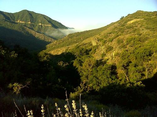
We start from the trailhead at the end of Upper Oso campground with full packs. Elevation 1,193 ft. Hiking up to the Santa Cruz trail that takes us to 19 Oaks trail camp in 2 miles. Elevation 1,709 ft., with a trail elevation gain of 516 ft. There will be a dayhike from 19 Oaks trailcamp on Saturday farther up the Santa Cruz trail to Little Pine Mountain, a hike of 5 miles. Elevation 4,459 ft., with a gain of 2,750 ft. Spectacular views at the top all the way to the Channel Islands over the ridgeline of the Santa Ynez Mountains. This hike takes us up through the different biomes of the mountains in the San Rafael Wilderness. We will be following Oso Creek from the trail head which has water for drinking and wading to the trail camp area with interesting geology along the way. Rain cancels.
Directions
Highway 101 north from the Los Angeles area to CA 154 in Santa Barbara. Follow CA 154 to Paradise Road, turn right, follow Paradise Road past the Santa Ynez River. Afterwhich, look for the turn off on the left to Upper Oso Campground. The trailhead is located at the end of Upper Oso campground, where we will meet.
About this event
We start from the trailhead at the end of Upper Oso campground with full packs. Elevation 1,193 ft. Hiking up to the Santa Cruz trail that takes us to 19 Oaks trail camp in 2 miles. Elevation 1,709 ft., with a trail elevation gain of 516 ft. There will be a dayhike from 19 Oaks trailcamp on Saturday farther up the Santa Cruz trail to Little Pine Mountain, a hike of 5 miles. Elevation 4,459 ft., with a gain of 2,750 ft. Spectacular views at the top all the way to the Channel Islands over the ridgeline of the Santa Ynez Mountains. This hike takes us up through the different biomes of the mountains in the San Rafael Wilderness. We will be following Oso Creek from the trail head which has water for drinking and wading to the trail camp area with interesting geology along the way. Rain cancels.
Directions to the trailhead
Get directionsHighway 101 north from the Los Angeles area to CA 154 in Santa Barbara. Follow CA 154 to Paradise Road, turn right, follow Paradise Road past the Santa Ynez River. Afterwhich, look for the turn off on the left to Upper Oso Campground. The trailhead is located at the end of Upper Oso campground, where we will meet.
Who's going (2)


Questions about this event?
Reach out to the host, Beachtype, for route details, carpooling, or what to bring.
Email the hostYou can also ask in the event discussion below.
Event discussion
No comments yet.
Log in to join the conversation.