
All events
Share
Moderate
Mt Potash Hike/Sabbaday Falls
<p>A great moderate half day hike with a side trip to Sabbaday Falls.</p>
Mt Potash Hike/Sabbaday Falls
<p>A great moderate half day hike with a side trip to Sabbaday Falls.</p>
Details
Located just south of the Kancamagus Highway in north-central New Hampshire, the summit of Potash Mountain, elevation 2,669 feet, provides outstanding 360-degree vistas of the southern White Mountains. Open ledges on its southeast face offer spectacular views of Hedgehog and Passaconaway mountains and beyond. Potash is a small, ledgy peak with steep, spruce-wooded sides and a flat top, poking up on the north side of the Sandwich Range. It is an excellent half-day hike, since its mostly open summit offers wide views in several directions. The views of the northern ridges and valleys of the Sandwich Range are especially notable. Total mileage for this out & back moderate hike is 4.4 miles with 1,450 elevation gain. We will take approx. 5 hours to complete, that allowing for a leisurely lunch and breaks.
Be sure to bring plenty of water, snacks & a lunch. As we will be deep into the late summer, it may be wise to bring light layers in case of cooler temperatures and a waterproof shell in case of unexpected rain or showers.
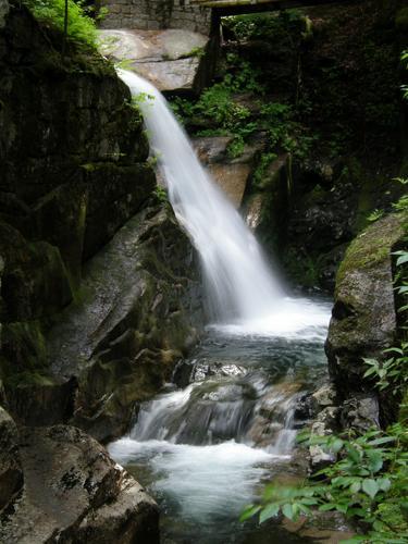
After the hike, we can take a short drive West on the Kancamagus to visit the picturesque Sabbaday Falls, soak our feet in the brook and then head over to either Lincoln or Conway for Pub & Grub, barring group consensus.
Directions
From the east, turn off NH 16 in Conway onto Kancamagus Highway (NH 112) and drive about 14.3 miles. From the west on I-93, take Exit 32 in Lincoln and drive about 21.8 miles on the Kancamagus.
You'll see a sign for the turn to the trailheads on the south side of the highway: the Downes Brook, UNH, and Mount Potash Trails. Turn here and drive into the large parking area. I will be driving a gray Nissan Cube.
About this event
Located just south of the Kancamagus Highway in north-central New Hampshire, the summit of Potash Mountain, elevation 2,669 feet, provides outstanding 360-degree vistas of the southern White Mountains. Open ledges on its southeast face offer spectacular views of Hedgehog and Passaconaway mountains and beyond. Potash is a small, ledgy peak with steep, spruce-wooded sides and a flat top, poking up on the north side of the Sandwich Range. It is an excellent half-day hike, since its mostly open summit offers wide views in several directions. The views of the northern ridges and valleys of the Sandwich Range are especially notable. Total mileage for this out & back moderate hike is 4.4 miles with 1,450 elevation gain. We will take approx. 5 hours to complete, that allowing for a leisurely lunch and breaks.
Be sure to bring plenty of water, snacks & a lunch. As we will be deep into the late summer, it may be wise to bring light layers in case of cooler temperatures and a waterproof shell in case of unexpected rain or showers.
After the hike, we can take a short drive West on the Kancamagus to visit the picturesque Sabbaday Falls, soak our feet in the brook and then head over to either Lincoln or Conway for Pub & Grub, barring group consensus.
Directions to the trailhead
Get directions Opens turn-by-turn directions to Waterville Valley, NH, 03215 in Google Maps (new tab).
From the east, turn off NH 16 in Conway onto Kancamagus Highway (NH 112) and drive about 14.3 miles. From the west on I-93, take Exit 32 in Lincoln and drive about 21.8 miles on the Kancamagus.
You'll see a sign for the turn to the trailheads on the south side of the highway: the Downes Brook, UNH, and Mount Potash Trails. Turn here and drive into the large parking area. I will be driving a gray Nissan Cube.
Who's going (3)
 SUSTAINING
 GUEST MEMBER
 SUSTAINING
Questions about this event?
Questions for the host, PineRiverPonder, about route details, carpooling, or what to bring? Ask in the event discussion below.
Event discussion
Log in to join the conversation.