
Mt. Washington - Davis Path Traverse
<p>A 20 mile mega-hike over Mt. Washington and the Davis Path.</p> <p></p>
Mt. Washington - Davis Path Traverse
<p>A 20 mile mega-hike over Mt. Washington and the Davis Path.</p> <p></p>
Details
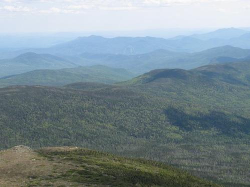
Trail Description: We start at the Cog Railway base station and hike up Mt. Washington on the Jewell Trail. This 3.6 mile trail is the easiest ascent to Mt Washington from the West. The grade is constant but seldom steep, there are no rock scrambles, and the footing is generally good below treeline and only moderately rough and rocky in the last section. The trail then connects to the Gulfside trail and another 1.4 miles takes us to the summit of Mt. Washington. After a break we will hike the entire Davis Path to Crawford Notch. This is a 14.4 mile descent on mostly moderate trails. On the way we will bag another NH 4000 footer: Mt. Isolation. Total distance is about 20 miles with cumulative elevation gain of 4500 ft. Total hiking time is 14 - 15 hours.
Equipment:
- headlamp (extra batteries?)
- extra layers of clothing. Weather at the summit can be unpredictable even on a summer day. Liner gloves and hat are recommended.
- Plenty of water
- Enough food for the day (even though Mt. Washington has a cafeteria, we don't plan to take a long break, but you can refill on water).
- Sunscreen, sun glasses
Fitness Level: This hike is in the "very strenuous" category and you need to be in tip top shape to participate. On the other hand, compared to a traditional Presidential Traverse, this hike is shorter with half the elevation gain on easier trails.
Camping: This is optional, but we will be camping at a nearby campground the night before and after the hike. We will try and spot cars the night before.
Rain date: Sunday August 12. Note this event cannot be rescheduled later due to the days getting too short.
Directions
We will start hiking at 5 am promptly. Please arrive a little early so we can start on time. Coming from I93 take Route 302 E to Bretton Woods. Turn left at Fabyan's Station Restaurant onto the Base Road. Continue six miles on Base Road to the Cog Base Station. We will meet at the trail head of the Jewell Trail.
About this event
Trail Description: We start at the Cog Railway base station and hike up Mt. Washington on the Jewell Trail. This 3.6 mile trail is the easiest ascent to Mt Washington from the West. The grade is constant but seldom steep, there are no rock scrambles, and the footing is generally good below treeline and only moderately rough and rocky in the last section. The trail then connects to the Gulfside trail and another 1.4 miles takes us to the summit of Mt. Washington. After a break we will hike the entire Davis Path to Crawford Notch. This is a 14.4 mile descent on mostly moderate trails. On the way we will bag another NH 4000 footer: Mt. Isolation. Total distance is about 20 miles with cumulative elevation gain of 4500 ft. Total hiking time is 14 - 15 hours.
Equipment:
- headlamp (extra batteries?)
- extra layers of clothing. Weather at the summit can be unpredictable even on a summer day. Liner gloves and hat are recommended.
- Plenty of water
- Enough food for the day (even though Mt. Washington has a cafeteria, we don't plan to take a long break, but you can refill on water).
- Sunscreen, sun glasses
Fitness Level: This hike is in the "very strenuous" category and you need to be in tip top shape to participate. On the other hand, compared to a traditional Presidential Traverse, this hike is shorter with half the elevation gain on easier trails.
Camping: This is optional, but we will be camping at a nearby campground the night before and after the hike. We will try and spot cars the night before.
Rain date: Sunday August 12. Note this event cannot be rescheduled later due to the days getting too short.
Directions to the trailhead
Get directionsWe will start hiking at 5 am promptly. Please arrive a little early so we can start on time. Coming from I93 take Route 302 E to Bretton Woods. Turn left at Fabyan's Station Restaurant onto the Base Road. Continue six miles on Base Road to the Cog Base Station. We will meet at the trail head of the Jewell Trail.
Who's going (2)

Questions about this event?
Reach out to the host, wildcat, for route details, carpooling, or what to bring.
Email the hostYou can also ask in the event discussion below.
Event discussion
No comments yet.
Log in to join the conversation.