
McAfee Knob Hike
<p> Great Hike to the Top of McAfee Knob!</p>
McAfee Knob Hike
<p> Great Hike to the Top of McAfee Knob!</p>
Details
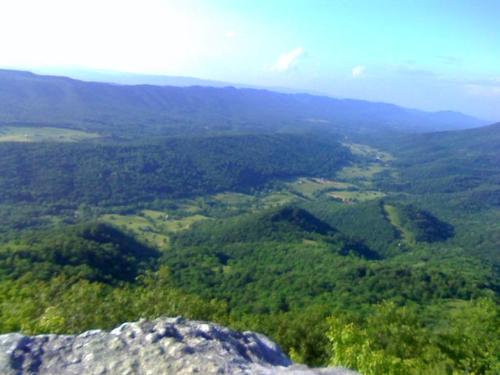
On this hike, we'll head up to McAfee Knob, one of the most photographed spots on the Appalachian Trail (A.T.) in Virginia. At the summit, the Knob has an almost 270 degree panorama of the Catawba Valley and North Mountain to the West, Tinker Cliffs to the North and the Roanoke Valley to the East. The hike is a steady climb of around 1700’ in about 4.4 miles to the Knob from the trailhead and parking area.
From the right side of the A.T., we will cross over Va. Hwy 311 and pick up the white blazed A.T. north. In about 0.3 miles there will be an information kiosk on the left. Continue on the A.T. crossing four wooden walkways prior to reaching the Johns Spring Shelter on the right in 0.8 miles.
There should be another five wooden walkways before reaching the Catawba Mountain Shelter in 1.4 miles. In less than 0.1 miles before the shelter on the left, we will pass a spring with a white pipe protruding from some rocks with a constant stream of water.
Remaining on the A.T., we'll cross an old fire road and continue through a high voltage power line clearing. In 0.3 miles past the power line clearing, we should have our first good overlook on the left looking down to the Catawba Valley. After another 0.5 miles further up the trail to the McAfee Knob Spur Trail, we'll turn left, and in about 30 yards will reach the top of the Knob with great views and McAfee Knob itself protruding out well beyond the rest of the cliffs.
For our return trip, we'll retrace your steps and head south on the A.T. back to the parking lot for a round trip total of 8.8 miles OR we'll take a shortcut back via the old fire road, making it a total hike of about 8.2 miles roundtrip.
Participants should wear boots or other sturdy shoes and bring plenty of water, a lunch, and whatever snacks they prefer on the way.
Directions
Take I-81 to exit 141 to VA 419/311. Turn left at the stoplight and drive 0.3 mile to the light at the VA 311 junction. Turn right and continue 5.5 miles to the parking area on the left at the top of the pass.
Hike is about 20 mins from downtown Roanoke.
We'll meet up at the trailhead, which is the Appalacian Trail on the East/North side of Va. Hwy 311 at 10am. We should be back by 3pm.
About this event
On this hike, we'll head up to McAfee Knob, one of the most photographed spots on the Appalachian Trail (A.T.) in Virginia. At the summit, the Knob has an almost 270 degree panorama of the Catawba Valley and North Mountain to the West, Tinker Cliffs to the North and the Roanoke Valley to the East. The hike is a steady climb of around 1700’ in about 4.4 miles to the Knob from the trailhead and parking area.
From the right side of the A.T., we will cross over Va. Hwy 311 and pick up the white blazed A.T. north. In about 0.3 miles there will be an information kiosk on the left. Continue on the A.T. crossing four wooden walkways prior to reaching the Johns Spring Shelter on the right in 0.8 miles.
There should be another five wooden walkways before reaching the Catawba Mountain Shelter in 1.4 miles. In less than 0.1 miles before the shelter on the left, we will pass a spring with a white pipe protruding from some rocks with a constant stream of water.
Remaining on the A.T., we'll cross an old fire road and continue through a high voltage power line clearing. In 0.3 miles past the power line clearing, we should have our first good overlook on the left looking down to the Catawba Valley. After another 0.5 miles further up the trail to the McAfee Knob Spur Trail, we'll turn left, and in about 30 yards will reach the top of the Knob with great views and McAfee Knob itself protruding out well beyond the rest of the cliffs.
For our return trip, we'll retrace your steps and head south on the A.T. back to the parking lot for a round trip total of 8.8 miles OR we'll take a shortcut back via the old fire road, making it a total hike of about 8.2 miles roundtrip.
Participants should wear boots or other sturdy shoes and bring plenty of water, a lunch, and whatever snacks they prefer on the way.
Directions to the trailhead
Get directionsTake I-81 to exit 141 to VA 419/311. Turn left at the stoplight and drive 0.3 mile to the light at the VA 311 junction. Turn right and continue 5.5 miles to the parking area on the left at the top of the pass.
Hike is about 20 mins from downtown Roanoke.
We'll meet up at the trailhead, which is the Appalacian Trail on the East/North side of Va. Hwy 311 at 10am. We should be back by 3pm.
Who's going (0)
No one is on the roster for this event.
Questions about this event?
Questions for the host, vahikerguy, about route details, carpooling, or what to bring? Ask in the event discussion below.
Event discussion
Scott
Log in to join the conversation.