
Harney Peak Hike
<p>Harney Peak from Sylvan Lake Hike</p>
Details
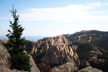
Harney Peak, the highest point in South Dakota at 7242 feet, can be accessed from several trails. We're going to take shortest and most popular route beginning at Sylvan Lake. Trail #9, as it is known, begins fairly easily and then slowly gains altitude with small streams of water visible next to - and crossing - the trail. We'll pass through an area recently (09-10) cleared to remove trees that had become infested with the pine beetle.
The trail continues upward, into the Black Hills Wilderness Area, becoming more steep in the final 1/2 mile. The trail ends at the summit at an abandoned stone fire tower built by the CCC in the 1930s. From the summit, hikers should have a near 360 degree view of the Black Hills and the high plains to the East.
The entire trail is about six miles total and should take 4-5 hours roundtrip. Be sure to check the weather forecast for Custer, SD and dress accordingly. Participants should bring water, snacks, and perhaps a lunch to eat along the way.
Please note that this hike is on a FRIDAY.
Directions
Trailhead is about an hour SW of Rapid City. Follow US16 to SD 87. Once through the Custer State Park entrance gate, drive past the park store and take your first left. Park in the lot at the end of this road, cross the footbridge and look for the trail information board where we'll meet up.
About this event
Harney Peak, the highest point in South Dakota at 7242 feet, can be accessed from several trails. We're going to take shortest and most popular route beginning at Sylvan Lake. Trail #9, as it is known, begins fairly easily and then slowly gains altitude with small streams of water visible next to - and crossing - the trail. We'll pass through an area recently (09-10) cleared to remove trees that had become infested with the pine beetle.
The trail continues upward, into the Black Hills Wilderness Area, becoming more steep in the final 1/2 mile. The trail ends at the summit at an abandoned stone fire tower built by the CCC in the 1930s. From the summit, hikers should have a near 360 degree view of the Black Hills and the high plains to the East.
The entire trail is about six miles total and should take 4-5 hours roundtrip. Be sure to check the weather forecast for Custer, SD and dress accordingly. Participants should bring water, snacks, and perhaps a lunch to eat along the way.
Please note that this hike is on a FRIDAY.
Directions to the trailhead
Get directionsTrailhead is about an hour SW of Rapid City. Follow US16 to SD 87. Once through the Custer State Park entrance gate, drive past the park store and take your first left. Park in the lot at the end of this road, cross the footbridge and look for the trail information board where we'll meet up.
Who's going (0)
No one is on the roster for this event.
Questions about this event?
Questions for the host, vahikerguy, about route details, carpooling, or what to bring? Ask in the event discussion below.
Event discussion
No comments yet.
Log in to join the conversation.