
The Carters (North, Middle, South)
<p>Come enjoy the Carters during peak foliage (Strenuous Hike), as I get close to completing my 4000 + footers.</p>
The Carters (North, Middle, South)
<p>Come enjoy the Carters during peak foliage (Strenuous Hike), as I get close to completing my 4000 + footers.</p>
Details
Gear/Conditions/hiker level; This is going to be a fall hike, above timberline and it is definitely a strenuous hike. Please be prepared for potential but unlikely full winter conditions. Please bring a warm hat, jacket, and gloves, headlight may be helpful but not required. Right now it does not look like microspikes will be needed, but I will advise as the time gets closer as to the conditions at higher elevations.
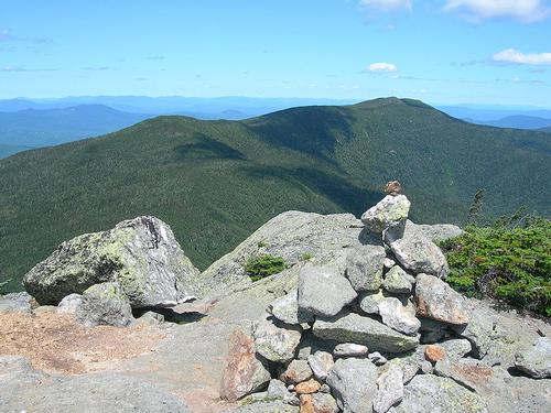
The hike itself; Just over 13 miles long it follows a section of the AT. Our ascent will bring us up the North End of the Imp Trail over the Imp Face (with excellent views), and on to the North Carter Trail up to the ridge. We will then follow the ridge south along the Carter-Moriah Trail over Middle Carter Mountain (4610 Ft. elevation) to South Carter Mountain (4430 Ft. Elevation). We will then backtrack north along the Carter-Moriah Trail to North Carter Mountail (4530 Ft. elevation). This will give us 3 seperate 4000 + footer peaks on our lists -)
Our descent will bring us back down the North Carter trail to the Southern segment of the Imp Trail loop to the trailhead at Rt.16 (which is going to be .3 miles South of the cars on Rt 16). We will walk north on Rt. 16 to the cars for the 3/10 mile. I am anticipating this taking roughly 8-9 hours depending upon pace, which will get us back well before dark.
We can go out to eat in Gorham afterwards for anyone who wishes to join.
Directions
We will meet at the Northern loop of the Imp Trailhead (.3 miles apart from South Imp Trailhead) at 9 AM on Sunday, Oct 16th. The northern end of the Imp Trailhead is on Rt. 16 just a few miles South of Gorham, NH (intersections of US Route 2 and NH Route 16) on the Eastern side of the road, it is just south of the Dolly Copp Campground entrance and the Androscoggin Ranger Station. There is a small trailhead sign located on the east side of the Rt. 16.
About this event
Gear/Conditions/hiker level; This is going to be a fall hike, above timberline and it is definitely a strenuous hike. Please be prepared for potential but unlikely full winter conditions. Please bring a warm hat, jacket, and gloves, headlight may be helpful but not required. Right now it does not look like microspikes will be needed, but I will advise as the time gets closer as to the conditions at higher elevations.
The hike itself; Just over 13 miles long it follows a section of the AT. Our ascent will bring us up the North End of the Imp Trail over the Imp Face (with excellent views), and on to the North Carter Trail up to the ridge. We will then follow the ridge south along the Carter-Moriah Trail over Middle Carter Mountain (4610 Ft. elevation) to South Carter Mountain (4430 Ft. Elevation). We will then backtrack north along the Carter-Moriah Trail to North Carter Mountail (4530 Ft. elevation). This will give us 3 seperate 4000 + footer peaks on our lists -)
Our descent will bring us back down the North Carter trail to the Southern segment of the Imp Trail loop to the trailhead at Rt.16 (which is going to be .3 miles South of the cars on Rt 16). We will walk north on Rt. 16 to the cars for the 3/10 mile. I am anticipating this taking roughly 8-9 hours depending upon pace, which will get us back well before dark.
We can go out to eat in Gorham afterwards for anyone who wishes to join.
Directions to the trailhead
Get directionsWe will meet at the Northern loop of the Imp Trailhead (.3 miles apart from South Imp Trailhead) at 9 AM on Sunday, Oct 16th. The northern end of the Imp Trailhead is on Rt. 16 just a few miles South of Gorham, NH (intersections of US Route 2 and NH Route 16) on the Eastern side of the road, it is just south of the Dolly Copp Campground entrance and the Androscoggin Ranger Station. There is a small trailhead sign located on the east side of the Rt. 16.
Who's going (1)
 GUEST MEMBER
Questions about this event?
Questions for the host, outdoorsyguy79, about route details, carpooling, or what to bring? Ask in the event discussion below.
Event discussion
No comments yet.
Log in to join the conversation.