
HIKE Joshua Tree - Lost Horse Mine Trail
<p>Moderate HIKE inside Joshua Tree Nat'l Park - 4 Mile - 3-4 Hour - Pack Lunch.</p>
HIKE Joshua Tree - Lost Horse Mine Trail
<p>Moderate HIKE inside Joshua Tree Nat'l Park - 4 Mile - 3-4 Hour - Pack Lunch.</p>
Details
Join us for an early January Hike in Joshua Tree on the Lost Horse Mine Trail.
Meet just before NOON at the Trail Head (Leader, Don has Grey Honda Element).
We'll hike 1/3 into the 4 mile loop, landing at the mine itself, and then climb to the top of the summit for a breathtaking view, and pack lunch (roughly 1pm). It'll likely be chilly, and a bit breezy atop summit, bring a fleece, windbreaker or light layers.
Our return will be via the loop (the other 2/3 of the 4 mile loop) back to the parking lot.
Joshua Tree Lost Horse Mine Trail
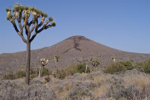
The views are stunning. The hike is moderate, not too strenuous, but certainly not flat, and requires agility. Bring a camera as well. Bring a pack lunch, plenty of water, and layers for wind & warmth. Check weather before leaving, its been a little chillier than normal here in So Cal these days.
Directions
Joshua Tree National Park lies 140 miles east of Los Angeles, 175 miles northeast of San Diego, and 215 miles southwest of Las Vegas. You can approach it from Interstate 10 and Hwy 62 (Twentynine Palms Highway).
The WEST Entrance (Joshua Tree Town) is the best entrance to reach Lost Horse Mine Trail. Maps provided at Visitors Center on Park Ave or at Gate 5 Miles up Park Ave inside the actual park.
Nat'l Park Pass, or Annual Pass will get you and passengers in without fee, otherwise typically $15 for car & driver and $5 each additional passenger (all to be split amongst group + voluntary gas money for driver).
About this event
Join us for an early January Hike in Joshua Tree on the Lost Horse Mine Trail.
Meet just before NOON at the Trail Head (Leader, Don has Grey Honda Element).
We'll hike 1/3 into the 4 mile loop, landing at the mine itself, and then climb to the top of the summit for a breathtaking view, and pack lunch (roughly 1pm). It'll likely be chilly, and a bit breezy atop summit, bring a fleece, windbreaker or light layers.
Our return will be via the loop (the other 2/3 of the 4 mile loop) back to the parking lot.
Joshua Tree Lost Horse Mine Trail
The views are stunning. The hike is moderate, not too strenuous, but certainly not flat, and requires agility. Bring a camera as well. Bring a pack lunch, plenty of water, and layers for wind & warmth. Check weather before leaving, its been a little chillier than normal here in So Cal these days.
Directions to the trailhead
Get directionsJoshua Tree National Park lies 140 miles east of Los Angeles, 175 miles northeast of San Diego, and 215 miles southwest of Las Vegas. You can approach it from Interstate 10 and Hwy 62 (Twentynine Palms Highway).
The WEST Entrance (Joshua Tree Town) is the best entrance to reach Lost Horse Mine Trail. Maps provided at Visitors Center on Park Ave or at Gate 5 Miles up Park Ave inside the actual park.
Nat'l Park Pass, or Annual Pass will get you and passengers in without fee, otherwise typically $15 for car & driver and $5 each additional passenger (all to be split amongst group + voluntary gas money for driver).
Who's going (1)
Questions about this event?
Log in to see who's hosting and to ask them questions in the event discussion.
Log in
Event discussion
No comments yet.
Log in to join the conversation.