
Mt. Jefferson Hike
<p> Hike up to one of NH's outstanding five-thousand footers on Labor Day Weekend.</p>
Mt. Jefferson Hike
<p> Hike up to one of NH's outstanding five-thousand footers on Labor Day Weekend.</p>
Details
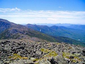
We will be hiking from Jefferson Notch, noted as the highest trailhead in all the Whites at 3,008ft. altitude. We will go up via the Caps Ridge Trail, which at 2.5 miles to the summit, always seems like an easy jaunt, yet the ups and downs of this trail, and the taunting of the four or five "false" summits make this 2,700 foot ascent almost double in actual climbing. The rewards are awesome, as most of this hike is above treeline, offering excellent views of the northern edge of the Presidentials. The return will be via the Castle Trail and the Link Trail back to the Caps Ridge Trail and eventually our cars. The return will be 4.2 miles for a total round trip of 6.7 miles. Bring good weatherproof gear and a warm fleece, plus lots of waters, and food. Rain will cancel this event.
Directions
We will be meeting at the trailhead parking lot in Jefferson Notch. The best way to access this is from US 302 in Bretton Woods. Whether you are coming north or south, turn at the Mt. Washington Cog Railway access road, which is called Base Road. This turn is clearly marked at Bretton Woods, next to Fabyan's restaurant, with a huge sign directing you to turn for the Cog Railway. At the crossroads with Mt. Clinton Road, turn left (north) onto Jefferson Notch Road (if you turn right you will be on Mt. Clinton Road). Go 3.4 miles and the parking lot will be on your right.
About this event
We will be hiking from Jefferson Notch, noted as the highest trailhead in all the Whites at 3,008ft. altitude. We will go up via the Caps Ridge Trail, which at 2.5 miles to the summit, always seems like an easy jaunt, yet the ups and downs of this trail, and the taunting of the four or five "false" summits make this 2,700 foot ascent almost double in actual climbing. The rewards are awesome, as most of this hike is above treeline, offering excellent views of the northern edge of the Presidentials. The return will be via the Castle Trail and the Link Trail back to the Caps Ridge Trail and eventually our cars. The return will be 4.2 miles for a total round trip of 6.7 miles. Bring good weatherproof gear and a warm fleece, plus lots of waters, and food. Rain will cancel this event.
Directions to the trailhead
Get directionsWe will be meeting at the trailhead parking lot in Jefferson Notch. The best way to access this is from US 302 in Bretton Woods. Whether you are coming north or south, turn at the Mt. Washington Cog Railway access road, which is called Base Road. This turn is clearly marked at Bretton Woods, next to Fabyan's restaurant, with a huge sign directing you to turn for the Cog Railway. At the crossroads with Mt. Clinton Road, turn left (north) onto Jefferson Notch Road (if you turn right you will be on Mt. Clinton Road). Go 3.4 miles and the parking lot will be on your right.
Who's going (6)
 SUSTAINING
 GUEST MEMBER
 SUSTAINING
Waiting list (2)
 GUEST MEMBER
 GUEST MEMBER
Questions about this event?
Reach out to the host, JPHiker, for route details, carpooling, or what to bring.
Email the hostYou can also ask in the event discussion below.
Event discussion
No comments yet.
Log in to join the conversation.