
Mt. Moosilauke Hike
<p> Hike to the summit of the westernmost of the NH four-thousand footers.</p>
Mt. Moosilauke Hike
<p> Hike to the summit of the westernmost of the NH four-thousand footers.</p>
Details
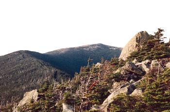
We will hike up via the Beaver Brook Trail, arguably among the most challenging of the trails up to the summit of Mt. Moosilauke (3.8 miles). It starts at Kinsman Notch (1,870 ft.) and ascends 3,100 ft. to the summit, which at 4,802 ft. is also among the highest of the NH 48. The hike up is along the Appalachian Trail and we will likely run into through hikers on their way up to Mt. Katahdin. The trail up is relentlessly steep, but quite beautiful as it goes along the Beaver Brook cascades before reaching the alpine meadows of the open summit. We will return via the moderate Benton Trail (3.6 miles) for a total of 7.4 miles. Come prepared for the open summit as it is always windy and chilly up there. Rain will cancel this event.
Directions
We will meet at the parking lot for the Beaver Brook trailhead. This is located on NH Rt. 112 at Kinsman Notch. From I-93 take exit 32 and go west on 112 (please note that east of I-93 Rt. 112 is called the Kancamagus). You will go through the town of Woodstock, where there is a traffic light. Continue on Rt. 112, here known as the Lost River Road, and go approximately 6 miles to Kinsman Notch. You will see a hiker's sign on the road, and the parking lot on the left. If you reach a pond on your left, you have gone too far. I drive a Rav4. Please try to be there by 9:00 a.m. as we need to spot cars at Benton Trailhead on Tunnel Brook Road, which will take anywhere from 30 to 45 minutes to arrange. Again, please note that inclement weather will cancel this event.
About this event
We will hike up via the Beaver Brook Trail, arguably among the most challenging of the trails up to the summit of Mt. Moosilauke (3.8 miles). It starts at Kinsman Notch (1,870 ft.) and ascends 3,100 ft. to the summit, which at 4,802 ft. is also among the highest of the NH 48. The hike up is along the Appalachian Trail and we will likely run into through hikers on their way up to Mt. Katahdin. The trail up is relentlessly steep, but quite beautiful as it goes along the Beaver Brook cascades before reaching the alpine meadows of the open summit. We will return via the moderate Benton Trail (3.6 miles) for a total of 7.4 miles. Come prepared for the open summit as it is always windy and chilly up there. Rain will cancel this event.
Directions to the trailhead
Get directionsWe will meet at the parking lot for the Beaver Brook trailhead. This is located on NH Rt. 112 at Kinsman Notch. From I-93 take exit 32 and go west on 112 (please note that east of I-93 Rt. 112 is called the Kancamagus). You will go through the town of Woodstock, where there is a traffic light. Continue on Rt. 112, here known as the Lost River Road, and go approximately 6 miles to Kinsman Notch. You will see a hiker's sign on the road, and the parking lot on the left. If you reach a pond on your left, you have gone too far. I drive a Rav4. Please try to be there by 9:00 a.m. as we need to spot cars at Benton Trailhead on Tunnel Brook Road, which will take anywhere from 30 to 45 minutes to arrange. Again, please note that inclement weather will cancel this event.
Who's going (1)
 SUSTAINING
Questions about this event?
Reach out to the host, JPHiker, for route details, carpooling, or what to bring.
Email the hostYou can also ask in the event discussion below.
Event discussion
No comments yet.
Log in to join the conversation.