
Santa Anita Canyon Loop/Mt Zion
<p>Santa Anita Canyon Loop / Mt. Zion / Sturtevant Falls .. 9.4 miles, over 2,000 ft of elevation gain, 5 1/2 hours</p>
Santa Anita Canyon Loop/Mt Zion
<p>Santa Anita Canyon Loop / Mt. Zion / Sturtevant Falls .. 9.4 miles, over 2,000 ft of elevation gain, 5 1/2 hours</p>
Details
Howdy Folks! I'm planning on doing a 9.4 mile loop hike with over 2,000 ft of elevation gain up Santa Anita Canyon to Sturtevant Falls, Sturtevant Camp and Mt. Zion. It should take about 5 1/2 - 6 hours. Afterwards, we can rendezvous at a local diner or burger joint for a late lunch.
This is a well-marked, well-travelled trail, so you can go at your own pace; go your own distance; just know your limitations. (For those who don't wish to do the entire loop, the hike to Sturtevant Falls (50 ft high!) and back is about 3 miles, tho it is still moderate-strenuous because of the ascent back up the hill to the parking area.
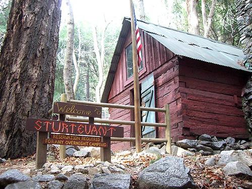
This is a scenic loop trip from Chantry Flat where we'll climb by way of the Gabrielino Trail to historic Sturtevant Camp, and return by way of the Mt. Zion and Upper Winter Creek trails. The highlights of this trip are sparkling streams, waterfall with botanical and historical interests. Here's a description from a hiking guide: "In the lush, shady recesses of Santa Anita Canyon and its tributary, Winter Creek, you can easily lose all sight and sense of the hundreds of square miles of dense metropolis, and the millions of people, that lie just over the ridge to the south. With easy access from the San Gabriel Valley by city street and mountain road, you can be strolling along a fern-lined path less than half an hour after leaving the freeway traffic behind."
Parking is tricky, that's why we're arriving early. Don't hesitate to contact each other, or contact me, to carpool. A National Forests Adventure Pass is required (available for purchase at the concession stand there ... another reason to carpool). A National Parks Pass also is accepted if you put it on your dash so it's visible through your windshield.
Be sure to check the weather for that day and dress appropriately. While it may be in the 60's in the sun on the exposed part of the mountain, we'll be hiking through the woods most of the time, under a canopy of shade with a cool breeze blowing down the canyon, and we'll be gaining a decent amount of elevation. I can't stress how important it is to dress in layers! (Rain cancels; threat of rain does not .. bring a poncho.)
Also, this is no time to diet. Eat a decent breakfast, bring some healthy snacks for during the hike, bring WATER, bring a jacket, and bring a camera 'cause it's pretty cool!
Several of my hiking buddies will be attending, so come and meet some new friends. Hope to see a bunch of you sign-up (and show-up!) Let me know for sure if you're attending 'cause I don't want to wait for stragglers. (lagoodguy@gmail.com)
Directions
From I-210 in Arcadia, follow Santa Anita Avenue north. Continue to the edge of the city, pass a sturdy gate and ascend along a curling and precipitous ribbon of asphalt to your destination at the end of the road: Chantry Flat. Spacious, but often inadequate partking lots, a ranger station, a picnic ground, and a mom-and-pop concession stand are here.
About this event
Howdy Folks! I'm planning on doing a 9.4 mile loop hike with over 2,000 ft of elevation gain up Santa Anita Canyon to Sturtevant Falls, Sturtevant Camp and Mt. Zion. It should take about 5 1/2 - 6 hours. Afterwards, we can rendezvous at a local diner or burger joint for a late lunch.
This is a well-marked, well-travelled trail, so you can go at your own pace; go your own distance; just know your limitations. (For those who don't wish to do the entire loop, the hike to Sturtevant Falls (50 ft high!) and back is about 3 miles, tho it is still moderate-strenuous because of the ascent back up the hill to the parking area.
This is a scenic loop trip from Chantry Flat where we'll climb by way of the Gabrielino Trail to historic Sturtevant Camp, and return by way of the Mt. Zion and Upper Winter Creek trails. The highlights of this trip are sparkling streams, waterfall with botanical and historical interests. Here's a description from a hiking guide: "In the lush, shady recesses of Santa Anita Canyon and its tributary, Winter Creek, you can easily lose all sight and sense of the hundreds of square miles of dense metropolis, and the millions of people, that lie just over the ridge to the south. With easy access from the San Gabriel Valley by city street and mountain road, you can be strolling along a fern-lined path less than half an hour after leaving the freeway traffic behind."
Parking is tricky, that's why we're arriving early. Don't hesitate to contact each other, or contact me, to carpool. A National Forests Adventure Pass is required (available for purchase at the concession stand there ... another reason to carpool). A National Parks Pass also is accepted if you put it on your dash so it's visible through your windshield.
Be sure to check the weather for that day and dress appropriately. While it may be in the 60's in the sun on the exposed part of the mountain, we'll be hiking through the woods most of the time, under a canopy of shade with a cool breeze blowing down the canyon, and we'll be gaining a decent amount of elevation. I can't stress how important it is to dress in layers! (Rain cancels; threat of rain does not .. bring a poncho.)
Also, this is no time to diet. Eat a decent breakfast, bring some healthy snacks for during the hike, bring WATER, bring a jacket, and bring a camera 'cause it's pretty cool!
Several of my hiking buddies will be attending, so come and meet some new friends. Hope to see a bunch of you sign-up (and show-up!) Let me know for sure if you're attending 'cause I don't want to wait for stragglers. (lagoodguy@gmail.com)
Directions to the trailhead
Get directionsFrom I-210 in Arcadia, follow Santa Anita Avenue north. Continue to the edge of the city, pass a sturdy gate and ascend along a curling and precipitous ribbon of asphalt to your destination at the end of the road: Chantry Flat. Spacious, but often inadequate partking lots, a ranger station, a picnic ground, and a mom-and-pop concession stand are here.
Who's going (0)
No one is on the roster for this event.
Questions about this event?
Questions for the host, FormerMember, about route details, carpooling, or what to bring? Ask in the event discussion below.
Event discussion
No comments yet.
Log in to join the conversation.