
Echo Mountain Hike
<p>Moderate to Strenuous Hike up Echo Mountain!</p> <p>We hike the short, steep, trail to the “The White City” and soak in the views. Hardy hikers may continue to Inspiration point.</p>
Echo Mountain Hike
<p>Moderate to Strenuous Hike up Echo Mountain!</p> <p>We hike the short, steep, trail to the “The White City” and soak in the views. Hardy hikers may continue to Inspiration point.</p>
Details
Howdy folks! I'm planning on doing a 2.5 mile up-and-back (5 mile round trip) hike with a 1700 ft elevation gain up Echo Mountain. This is local and easy to get to. It's historic and it's gorgeous. This is a well-marked, well-travelled trail, so you can go at your own pace; go your own distance; just know your limitations. Allow a few hours, at least.
Check the weather for Sunday and dress appropriately. While it may be in the 60's in the sun at the base of the mountain, chances are we'll be hiking through some woods and chapparral, under a canopy of shade with some cool wind blowing down the canyon, and we're gaining a decent amount of elevation. Can't stress how important it is to dress in layers! (Rain cancels; threat of rain does not .. bring a poncho. Call if unsure: 323-493-0104/Klaus)
Also, this is no time to diet. Eat a decent breakfast, bring some healthy snacks for during the hike, bring WATER, bring a jacket, and bring a camera 'cause it's pretty cool.
Here's a blurb from a book about the trail: "Hikers are taking new interest in the old Mt. Lowe Railway road bed; the Rails-To-Trails Conservancy (which promotes the conversion of abandoned rail corridors into recreation trails) ranked the Lowe Railway as one of the nation's 12 most scenic and historically significant recycled rail lines. The Forest Service and volunteers have put together a self-guiding trail, featuring markers fashioned from railroad rails, along the route of the mountain trolley. The most exciting way to reach Station 1 at Echo Mountain is to go by way of the Sam Merrill Trail from Altadena, CA.
And, that's what we're doing!
Hope to see you! Let me know if you're attending 'cause I don't want to wait for stragglers.
Directions
To Reach the Trailhead: The Sam Merrill trailhead lies on the grounds of the long-demolished Cobb Estate, at the intersection of Lake Ave and Loma Alta Drive in Altadena. Take the Lake Avenue exit from East- or west-bound I-210 in Pasadena, and drive about 3 miles north to where Lake Ave turns left (west) and becomes Loma Alta Drive. Park on the street (no adventure Pass needed).
About this event
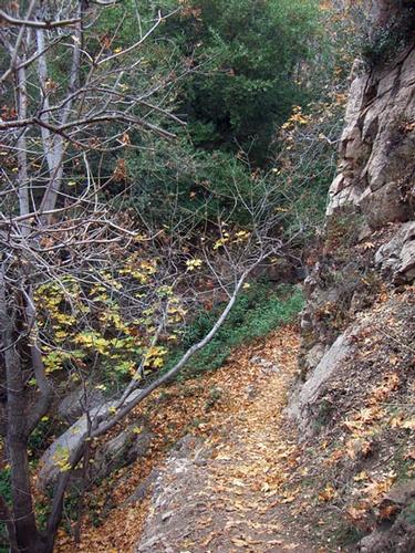
Howdy folks! I'm planning on doing a 2.5 mile up-and-back (5 mile round trip) hike with a 1700 ft elevation gain up Echo Mountain. This is local and easy to get to. It's historic and it's gorgeous. This is a well-marked, well-travelled trail, so you can go at your own pace; go your own distance; just know your limitations. Allow a few hours, at least.
Check the weather for Sunday and dress appropriately. While it may be in the 60's in the sun at the base of the mountain, chances are we'll be hiking through some woods and chapparral, under a canopy of shade with some cool wind blowing down the canyon, and we're gaining a decent amount of elevation. Can't stress how important it is to dress in layers! (Rain cancels; threat of rain does not .. bring a poncho. Call if unsure: 323-493-0104/Klaus)
Also, this is no time to diet. Eat a decent breakfast, bring some healthy snacks for during the hike, bring WATER, bring a jacket, and bring a camera 'cause it's pretty cool.
Here's a blurb from a book about the trail: "Hikers are taking new interest in the old Mt. Lowe Railway road bed; the Rails-To-Trails Conservancy (which promotes the conversion of abandoned rail corridors into recreation trails) ranked the Lowe Railway as one of the nation's 12 most scenic and historically significant recycled rail lines. The Forest Service and volunteers have put together a self-guiding trail, featuring markers fashioned from railroad rails, along the route of the mountain trolley. The most exciting way to reach Station 1 at Echo Mountain is to go by way of the Sam Merrill Trail from Altadena, CA.
And, that's what we're doing!
Hope to see you! Let me know if you're attending 'cause I don't want to wait for stragglers.
Directions to the trailhead
Get directionsTo Reach the Trailhead: The Sam Merrill trailhead lies on the grounds of the long-demolished Cobb Estate, at the intersection of Lake Ave and Loma Alta Drive in Altadena. Take the Lake Avenue exit from East- or west-bound I-210 in Pasadena, and drive about 3 miles north to where Lake Ave turns left (west) and becomes Loma Alta Drive. Park on the street (no adventure Pass needed).
Who's going (0)
No one is on the roster for this event.
Questions about this event?
Questions for the host, FormerMember, about route details, carpooling, or what to bring? Ask in the event discussion below.
Event discussion
No comments yet.
Log in to join the conversation.